Mapping Cities: Barcelona and Paris
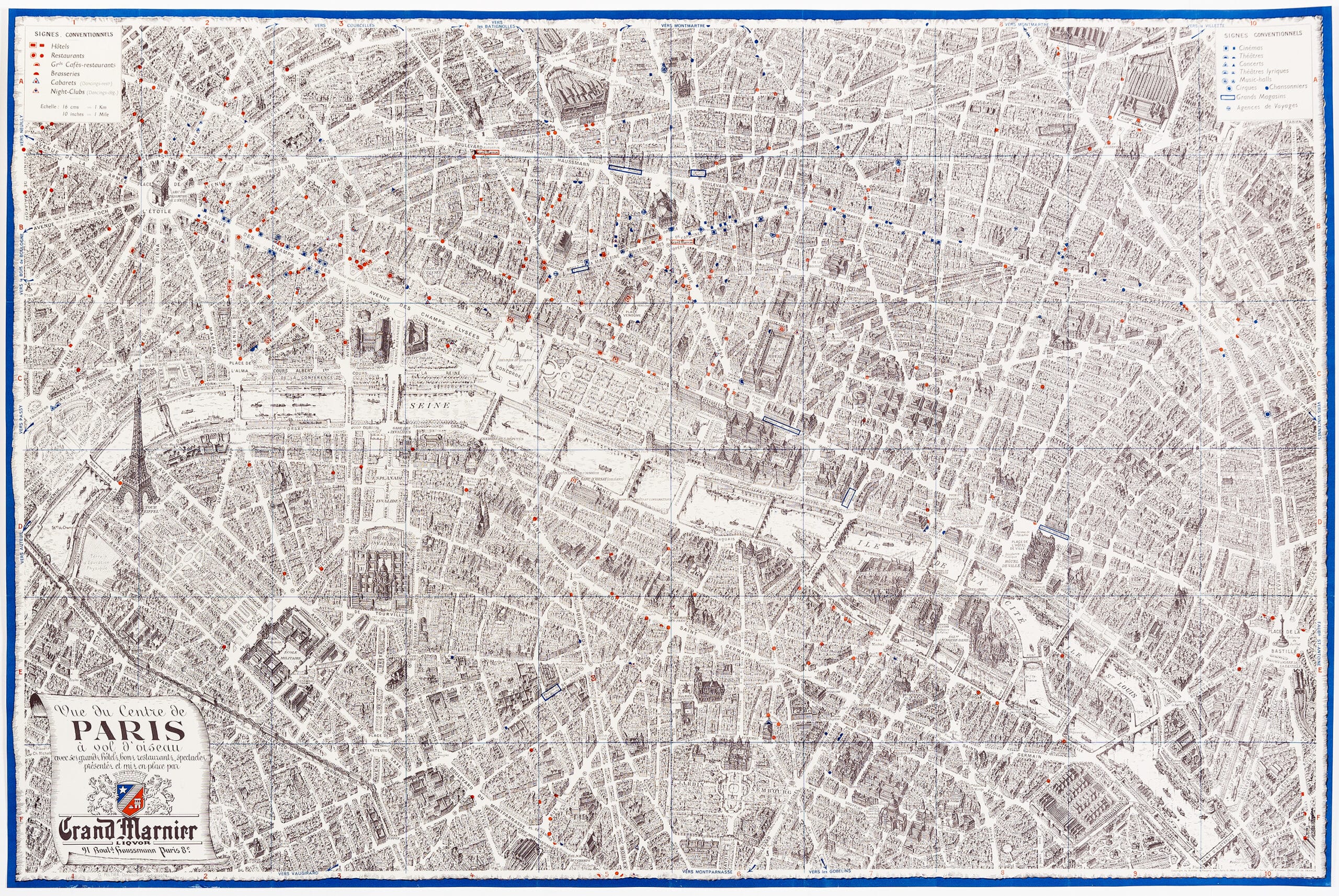
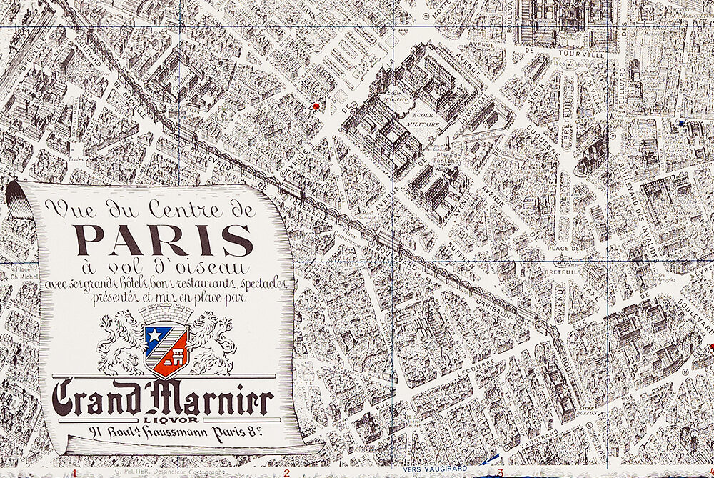
– Dibujantes CNT and Grand Marnier
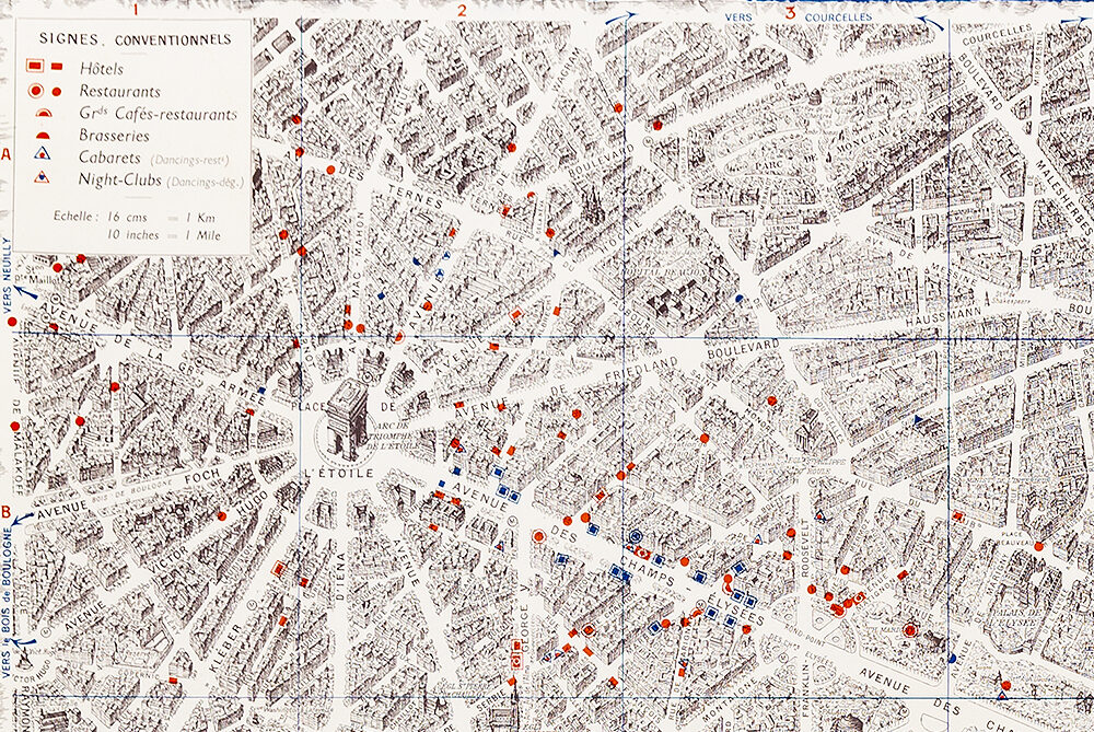
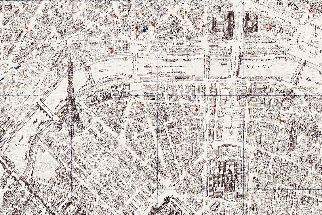
Prompted by the publication of Laurence Le Bras and Emmanuel Guy’s text on Guy Debord’s situationist maps of Paris, a closer look at two ways to represent the experience of a city…
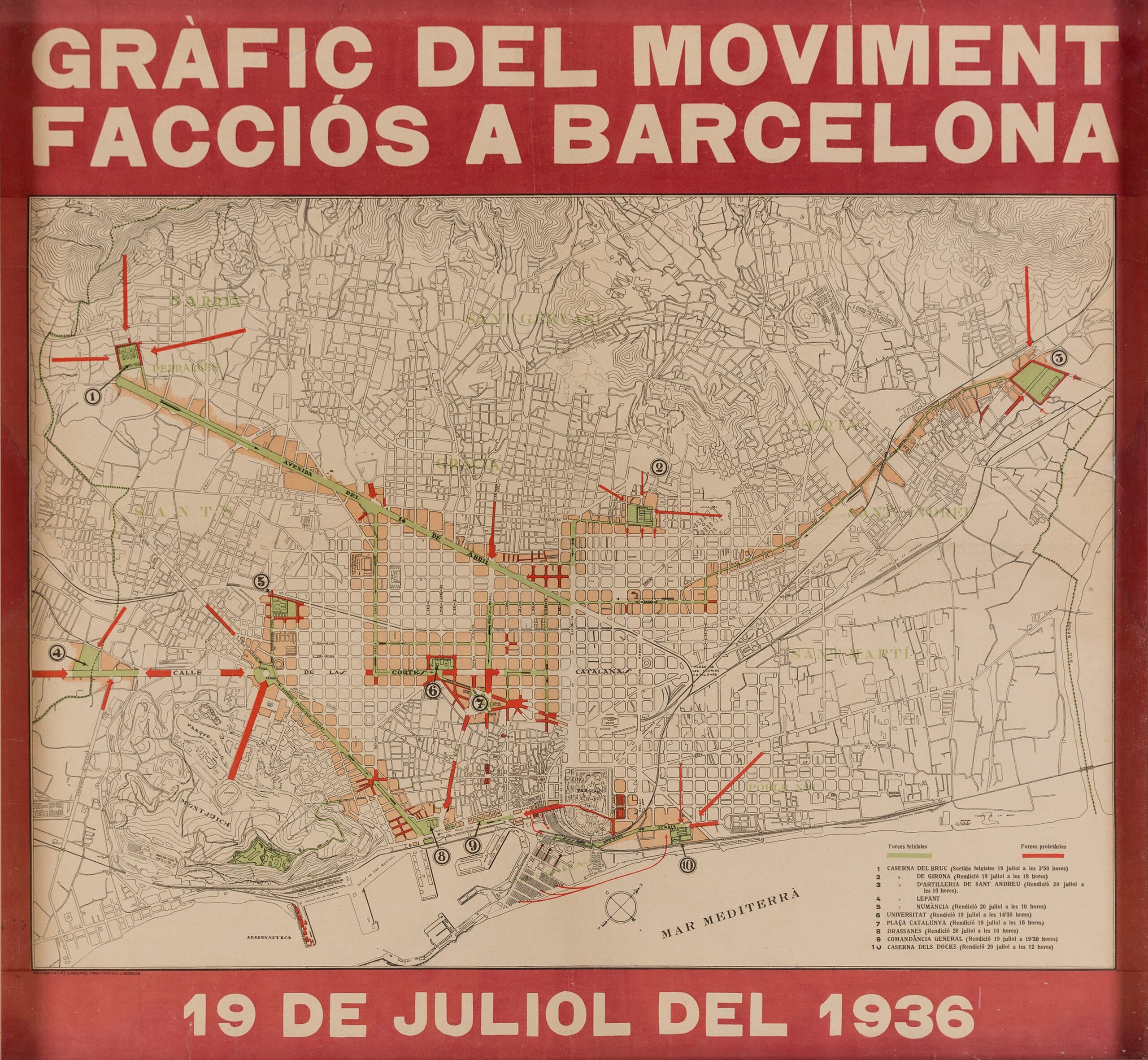
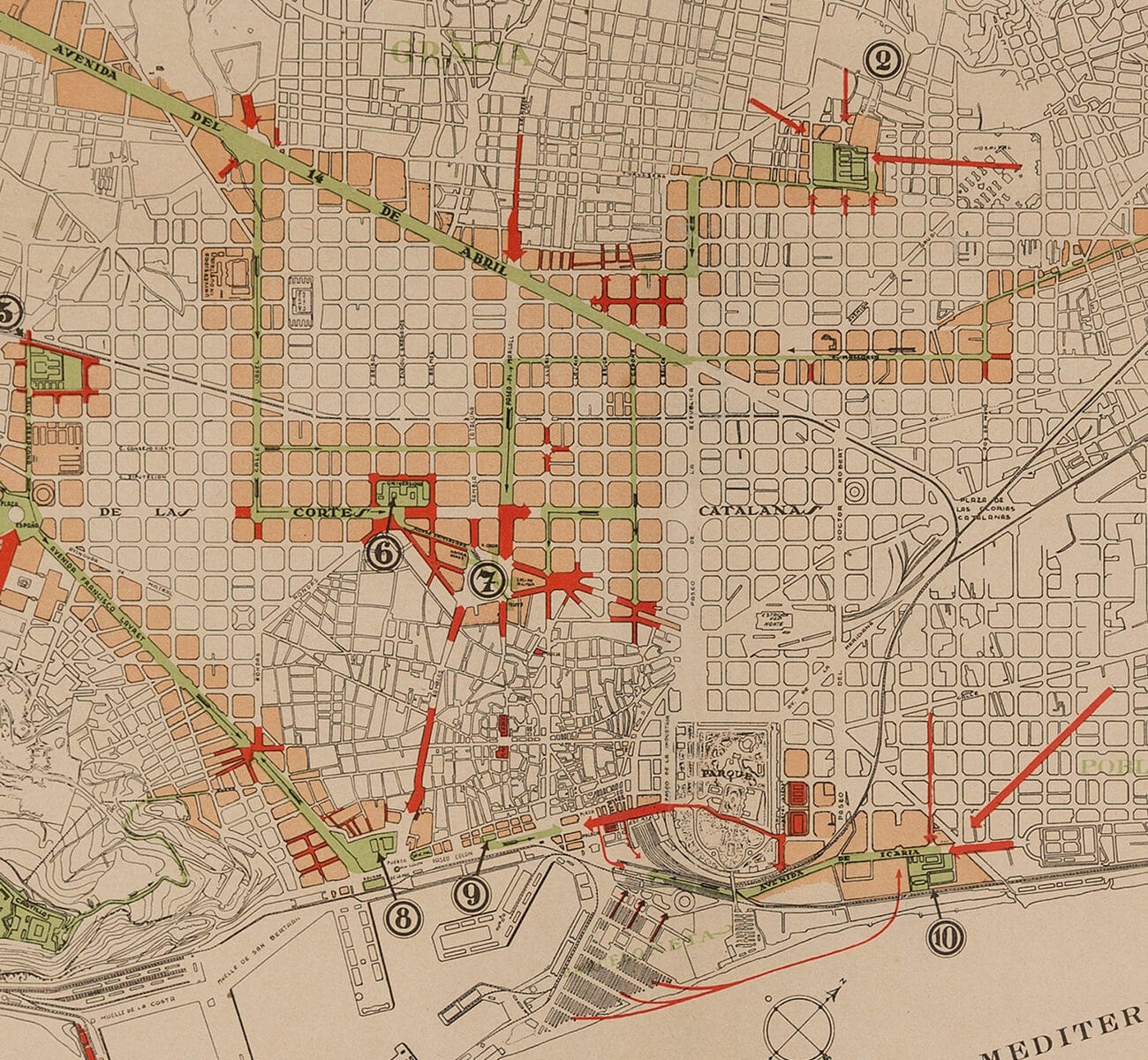
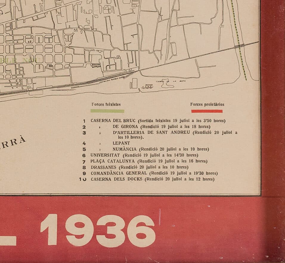
This poster commemorates the successful resistance of the City of Barcelona to the military insurgency that initiated the Spanish Civil War. It was issued by the Generalitat de Catalunya, the autonomous government of Catalonia, shortly after 19 July 1936, and designed by members of the CNT, who had taken control of the city. The Forces Feixistes are represented in green and the Forces Proletàries in red.
Read more on the insurgency here in an excerpt from Anthony Beevor’s The Battle for Spain:
The Spanish Civil War 1936-1939 (London: Weidenfeld & Nicolson, 2007).