Pan Scroll Zoom 16: Luis Callejas
The Forest Clearing as Archetype
This is the sixteenth in a series of texts edited by Fabrizio Gallanti on the challenges in the new world of online architectural teaching and, particularly, on the changing role of drawings in presentations and reviews. Here, Luis Callejas (LCLA OFFICE) discusses his teaching studios at the Yale School of Architecture and the Oslo School of Architecture and Design (AHO).
Over the past decade, the work developed in our office has explored how a modelled landscape is of a higher order of importance than the actual, real site. For us, the real site is the constructed model, the artificial and edited survey of a site, and therefore site visits behave more like late means of verification than early primordial inspiration. The reality of the project is thus the artificial space constructed from our own surveys, which not only serve as a portrait and the reality of a site, but also contain the key geometric inclinations and formal tendencies that later become the clues for architecture.
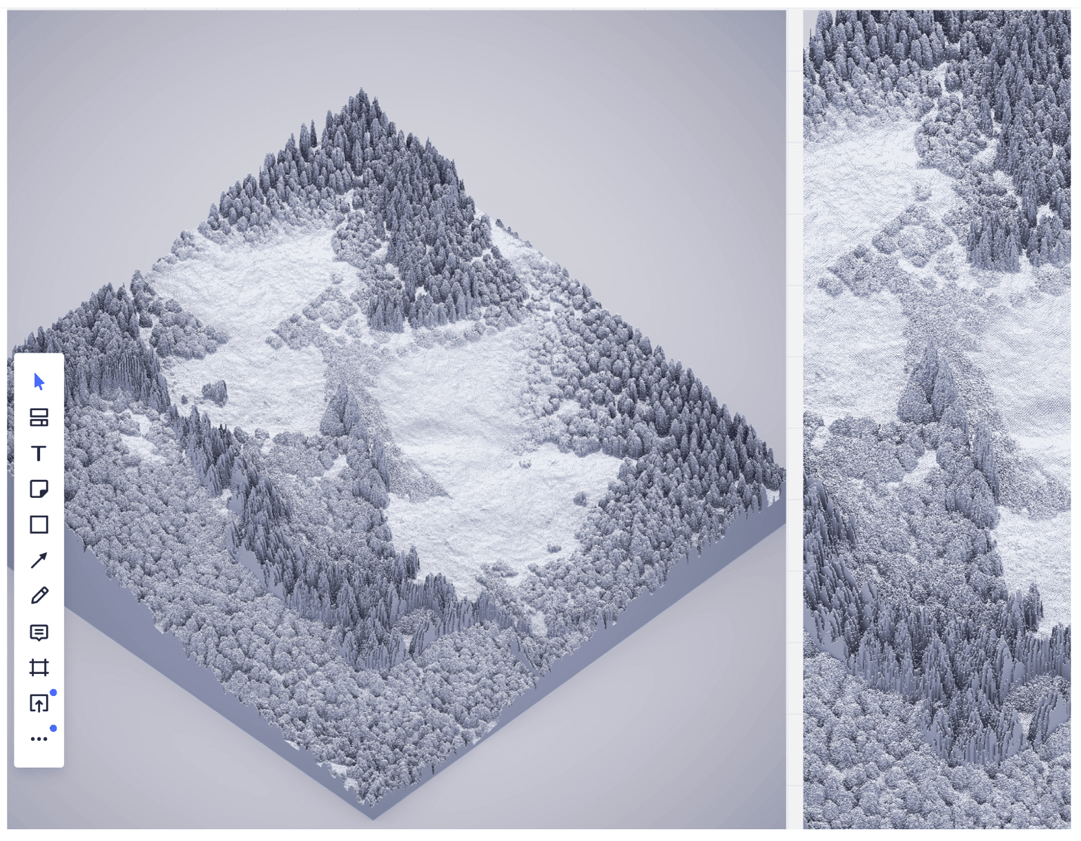
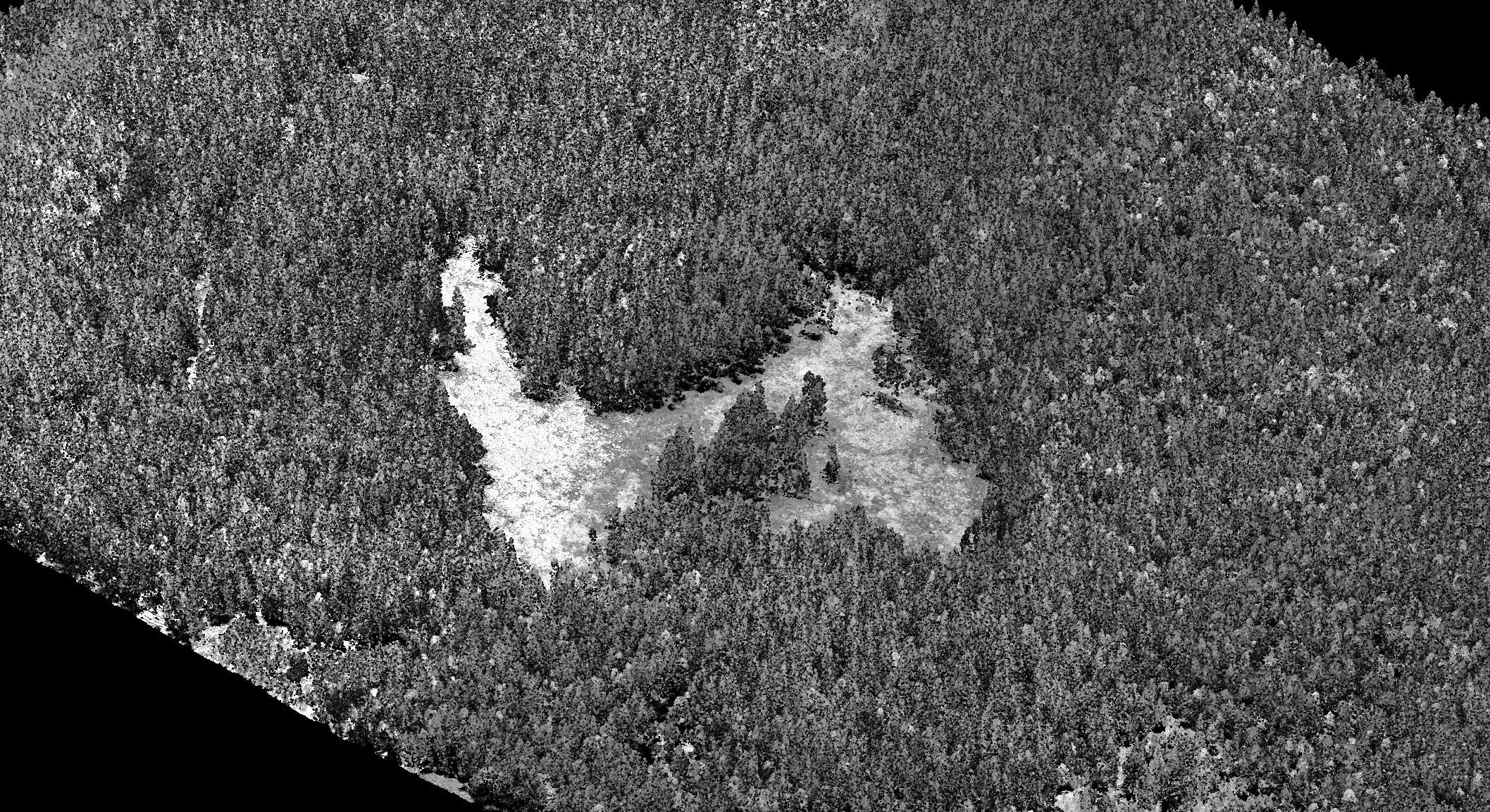
The need to experience a site to be qualified to modify it, or design for it, is prevalent among architects and landscape architects, but the reality of most projects is that the early steps of design happen by editing a topographical survey constructed by someone else. The methods for constructing a poetic and pragmatic survey of a forest clearing were the central theme of our studio at Yale and the Oslo schools of architecture. In the past, we have addressed the landscapes of the island, the ocean, the mountain and the desert, each of which was studied as a canonical landscape type in which certain geometrical conditions can be extracted to inform design anywhere. These landscapes were studied through the lens of a surveying technique particularly suited to explore a ground condition or the particular predominant geometries of a landscape type, such as sand dune movement in the desert, or Lidar scans of a forest that present trees as a kind of topography. Looking at the artistic merit of each technique allowed us to derive formal operations pertinent to design in each landscape without the need to physically visit them. The scale-less nature of these explorations ends up informing design acts from the smallest detail to the largest scales of a landscape intervention.
This way of working is seen sometimes as a taboo, especially among peers and schools that still see the act of site visits as a fundamental moment that should not be evaded. When travelling restrictions started back in 2020, many of our colleagues in Oslo were terrified of the consequences of not travelling with students. In a school like the Oslo School of Architecture where influential characters such as Christian Norbert Schulz and Sverre Fehn were so present, and to this day instil influence, this situation seemed even more daunting. It is a school in which architects have been trained for decades to listen to the site and wait for it to tell them what is pertinent to do.
We were invited by Deborah Berke to teach a studio at Yale University as Louis Kahn visiting faculty. We had been planning this studio at Yale for a while, but, unfortunately, our time coincided with the complete closure of schools in the United States and Norway. The closure seemed like the perfect opportunity to test the limits of the idea of designing for a delicate landscape by sidestepping direct site experience.
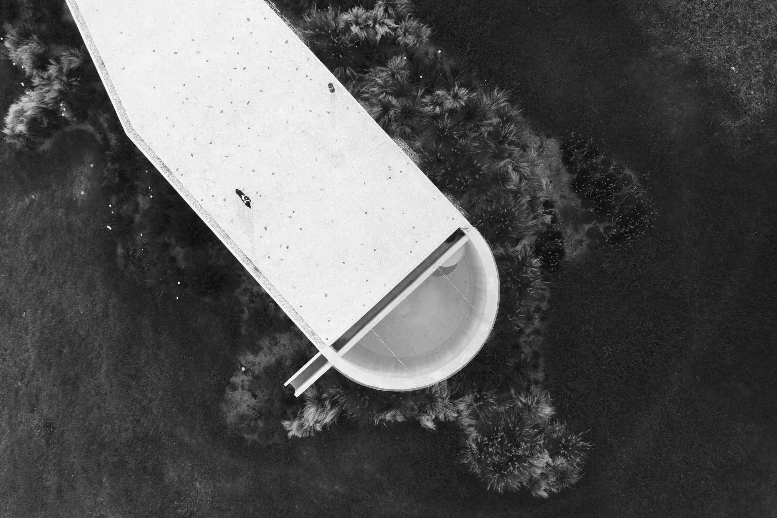
We decided to organise the studio as a dual collaborative effort with students from Yale and the Oslo School of Architecture. The site for the studio was the sophisticatedly managed urban forest around Oslo, a perfect landscape for this experiment in many ways as in Norway the forest has been surveyed with a highly complex level of detail, and the Lidar databases are public and relatively easy to access. And while the students in Oslo didn’t have access to the school, they could still visit the forest at anytime, as the forests around Oslo, even if private, are available for public use for recreation.
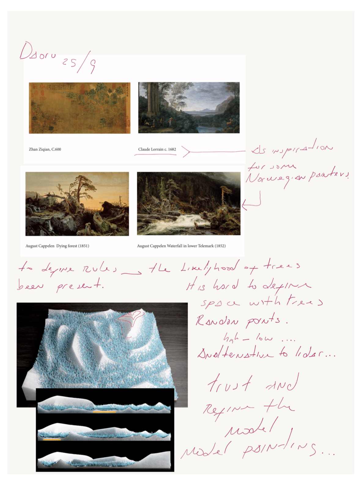
The studio challenged a recent tendency in Scandinavia to think about wood and vernacular wood construction as the universal solution for contemporary architectural problems, especially questions of sustainability. As we discovered, even Sverre Fehn was concerned with the abuse of vernacular motifs and the fascination with wooden cabins and small houses in Norway, which still remain as one of the preferred themes for architects in Scandinavia. Our studio was therefore not concerned at all with wood construction but rather with where wood comes from and the spatial consequences of its foresting, and the forest as a space that will change as we move towards more intensive use of wood.
‘[Here in Norway] you won’t find anything especially inspired [by the forest] from an architectonic point of view. And then this passion for traditional log houses. All these farms and barns, they take up so much space, it’s absurd to try to develop this trend any further today. This is also a form of romanticism that we haven’t managed to do anything with – we really haven’t managed to do much at all with the log.’
– Sverre Fehn interviewed by Ingerid Helsing Almaas, Architecture Norway, 10 May, 2010.
Beyond the fascination with this artificial landscape in Oslo, the studio also exposed the contrast between students who could only rely on hard data and models versus another group with access to the same data and direct experience. Both groups were international, and even though Oslo had some Norwegian students, we didn’t consider that the command of the Norwegian language would give them many advantages in interpreting data and texts. The exercises were primarily visual thus not knowing Norwegian was not really a major problem for the students at Yale.
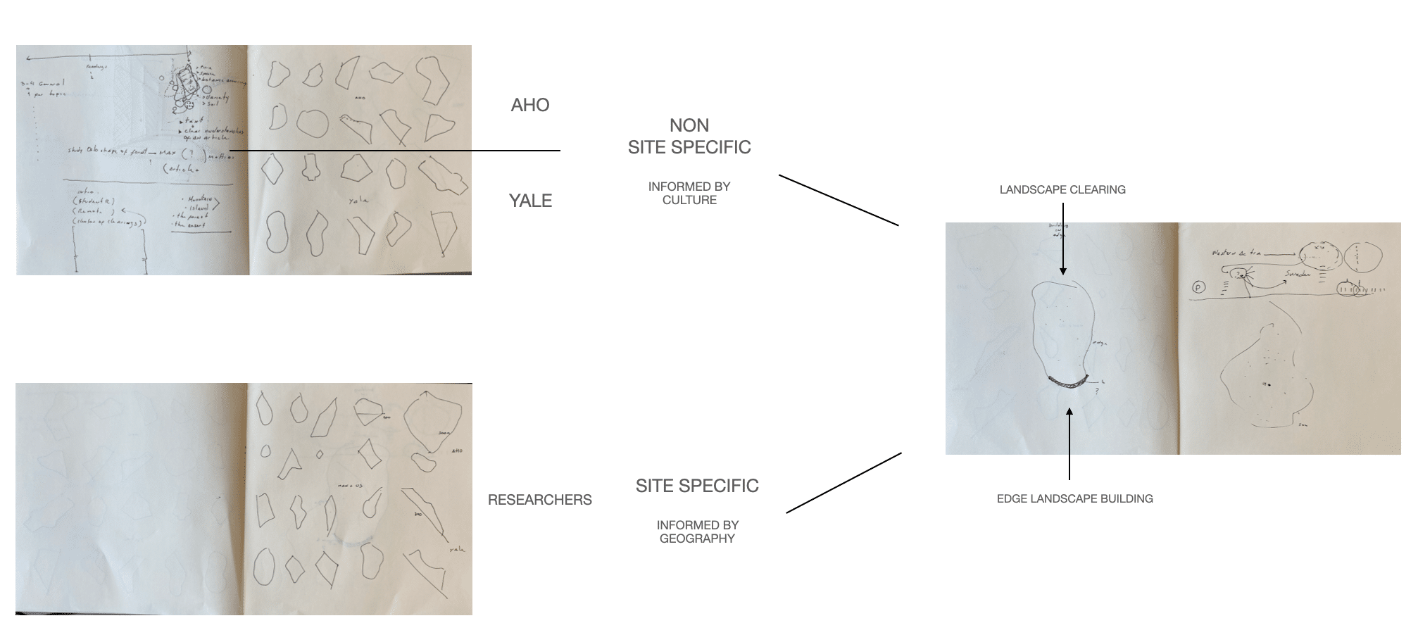
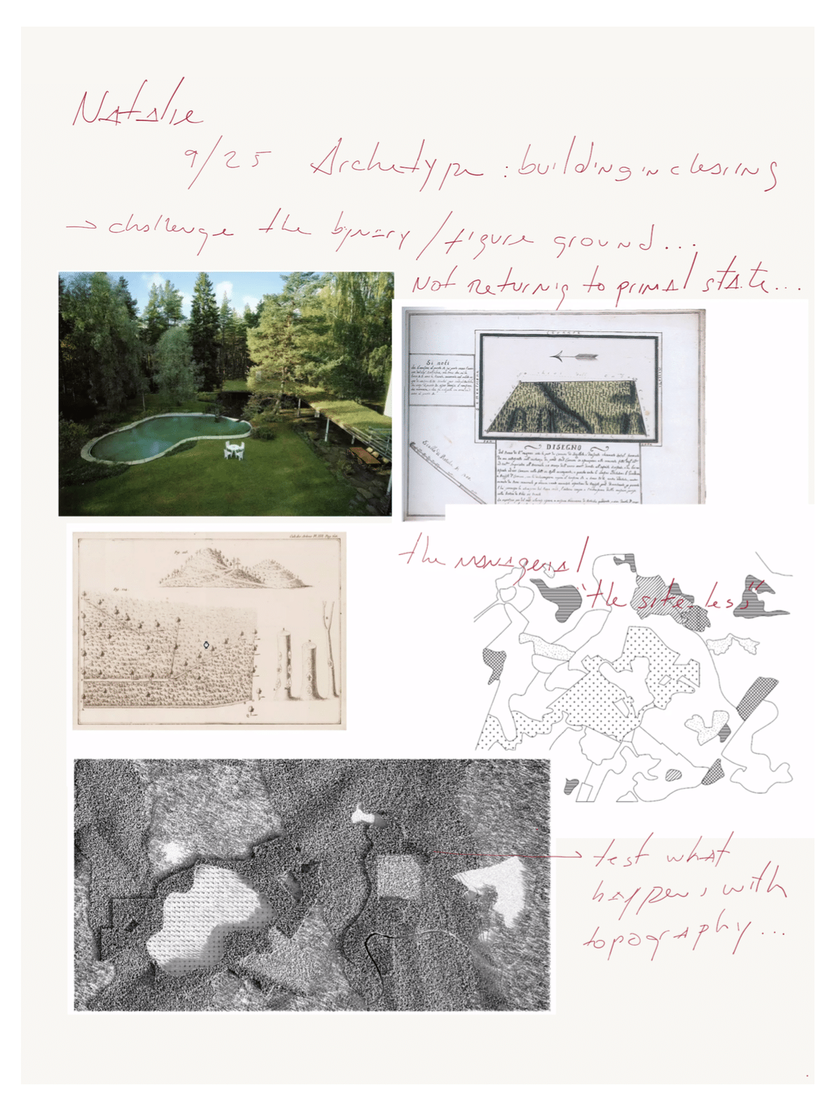
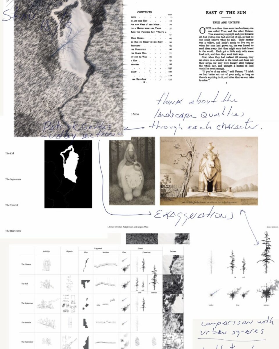
The starting point of the studio was to have an equal ground for the students at Yale and Oslo. Both groups started with the invention of an abstract site in which to test an archetypal space that would not depend on a real site-specific survey. The concept of the forest clearing as an archetypal space was ideal as it is possible to engage conceptually with the figure of the forest clearing regardless of cultural or geographic boundaries. The forest clearing as a primordial space can be found in sources as diverse as Martin Heidegger’s writings on the metaphor of space and mind, describing it through the use of the German words Lichtung (which means lighting), all the way to its presence in Chinese literature, children’s books and so on. That is precisely the reason why we can call the clearing an archetypal space: it is a spatial metaphor that can be explored with the sophistication of Heidegger’s writings but can also be used to describe the intense spatial experience of a child in any forest, anywhere.
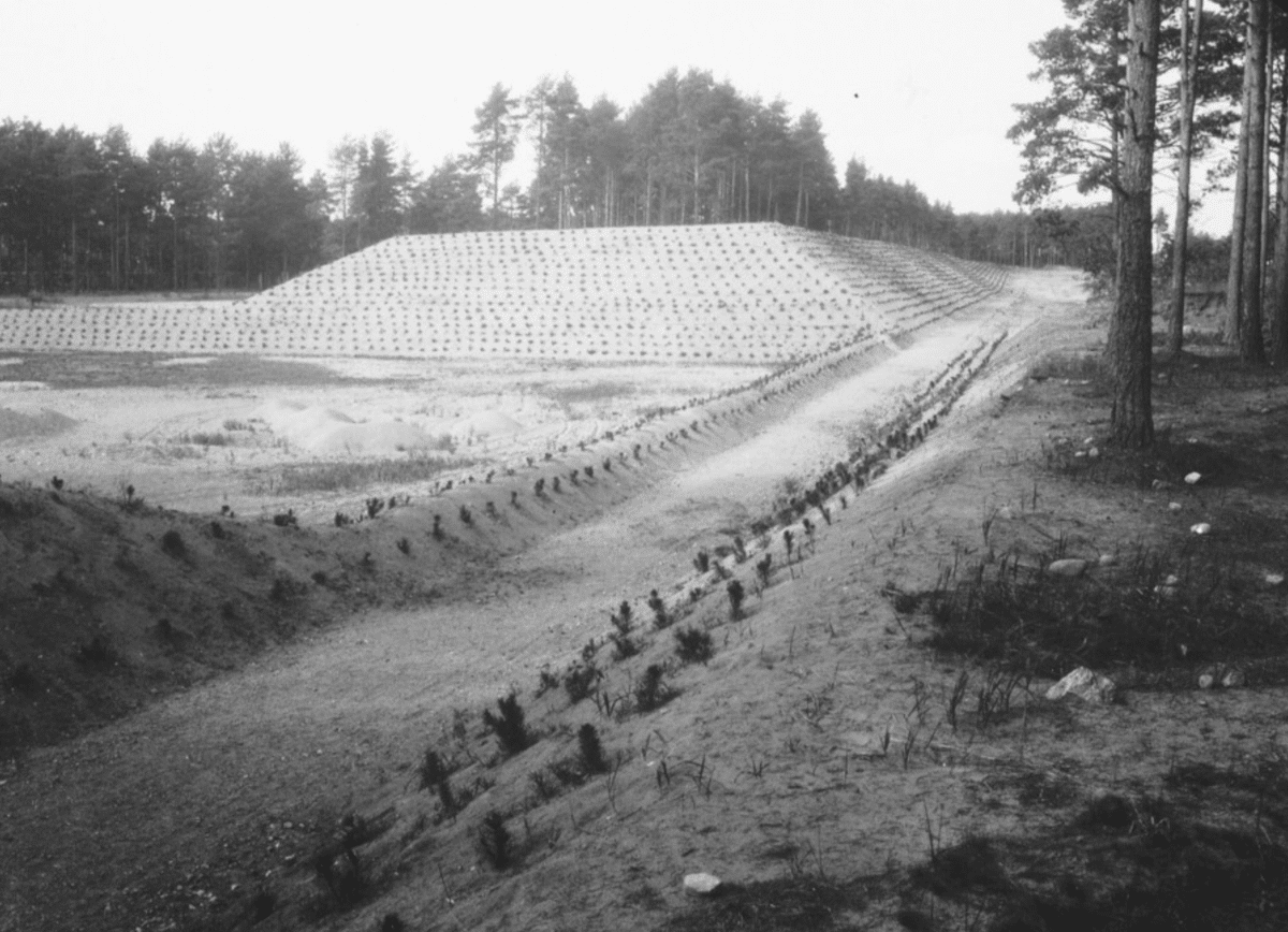
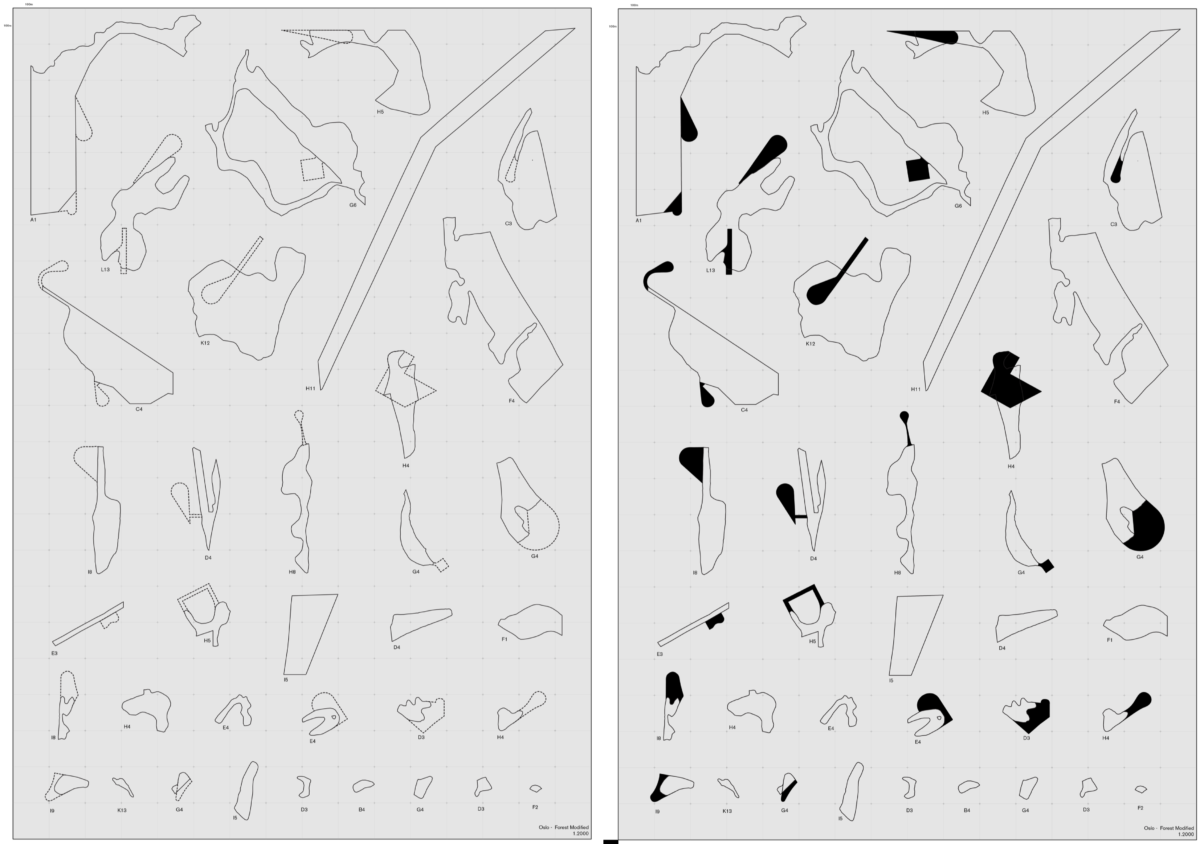
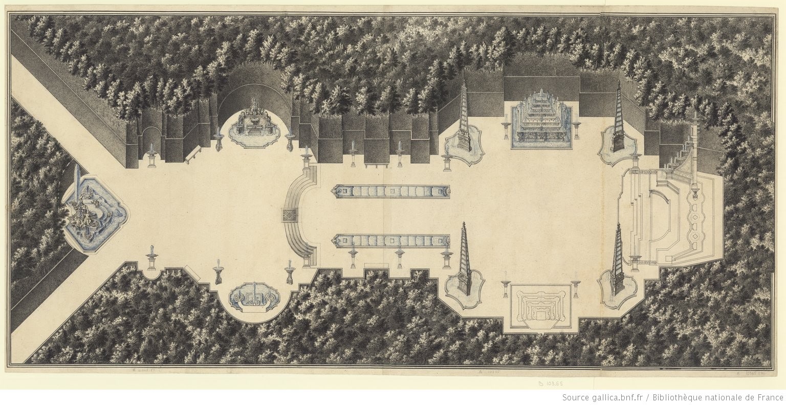
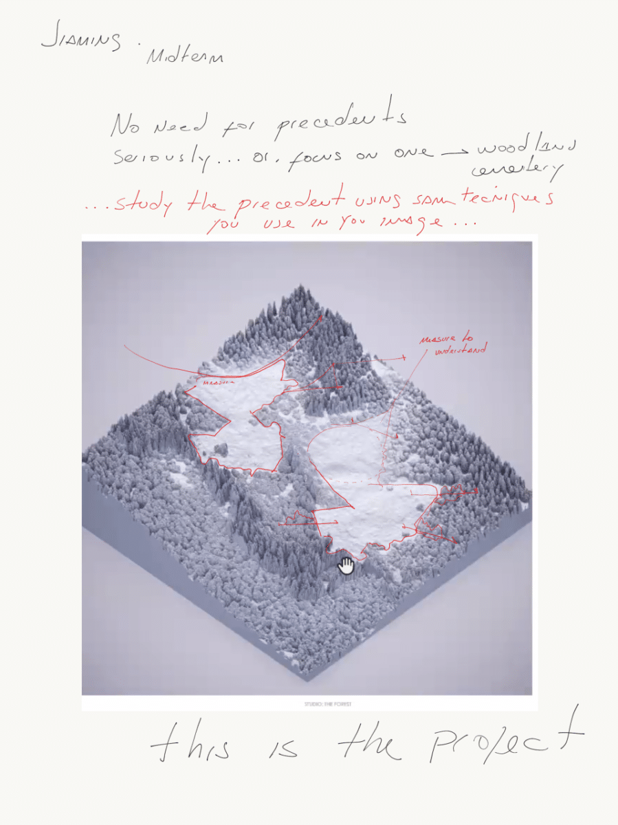
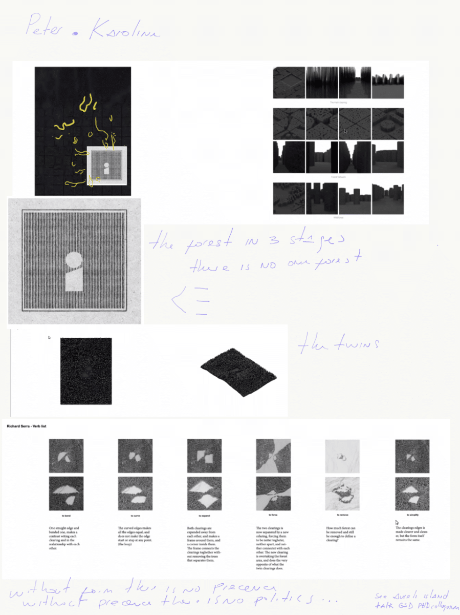
The students moved on to invent a topography and design a prototypical forest. The design exercise was to later ‘edit’ this invented forest in order to shape a proto-architectural space made up of trees of different species and ages with a limited set of tools derived from forestry practices. The invented area of study was between 300m to 1.5km, a model of the vegetated mass represents the predominant tree cover. To produce the models students analysed images and aerial photos of the forest around Oslo to estimate tree height, planting distance, predominant species, density and other parameters that determine spatial conditions. The finished model was composed of a vegetated mass in which approximately 30% of the trees were removed or edited. As as formal reference students looked at planimetric drawings of French bosquets.
The exercise was eye-opening for many, especially those used to drawing a site as an analytical act, or merely as a documentation tool; the method was also a shock to students used to designing space as an additive process. In our studio, the roles were inverted. The documentation of the site was the inventive act, as it required students to experiment with the representation of trees as both mass and individuals, while shaping space, or shaping the clearing, was analytical: more editing and subtraction rather than a process of invention by addition. I told them that perhaps this was not that different from planning and executing a haircut, creating form by trimming or thinning.
While the students were shaping and inventing an archetypal clearing, they were learning the mechanisms to give form to space within the formal vocabulary of forestry practices. They were also learning that architecture doesn’t have to be limited to the perimeter of the building and that it is possible to shape exterior areas rather than just using the forest as a source of inspiration for an inert building. In this first exercise architecture students learned that the limits between architecture and landscape architecture are artificial disciplinary constructions. On the other hand, our landscape architecture students in Oslo learned that some of their tools and media can in fact give origin to early ideas of buildings beyond just informing their positioning. The initial month working without a site, and having students from architecture and landscape architecture facing the same problem, was necessary to create a shared formal vocabulary between architect and landscape architects.
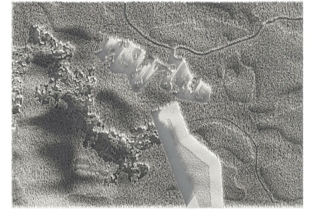
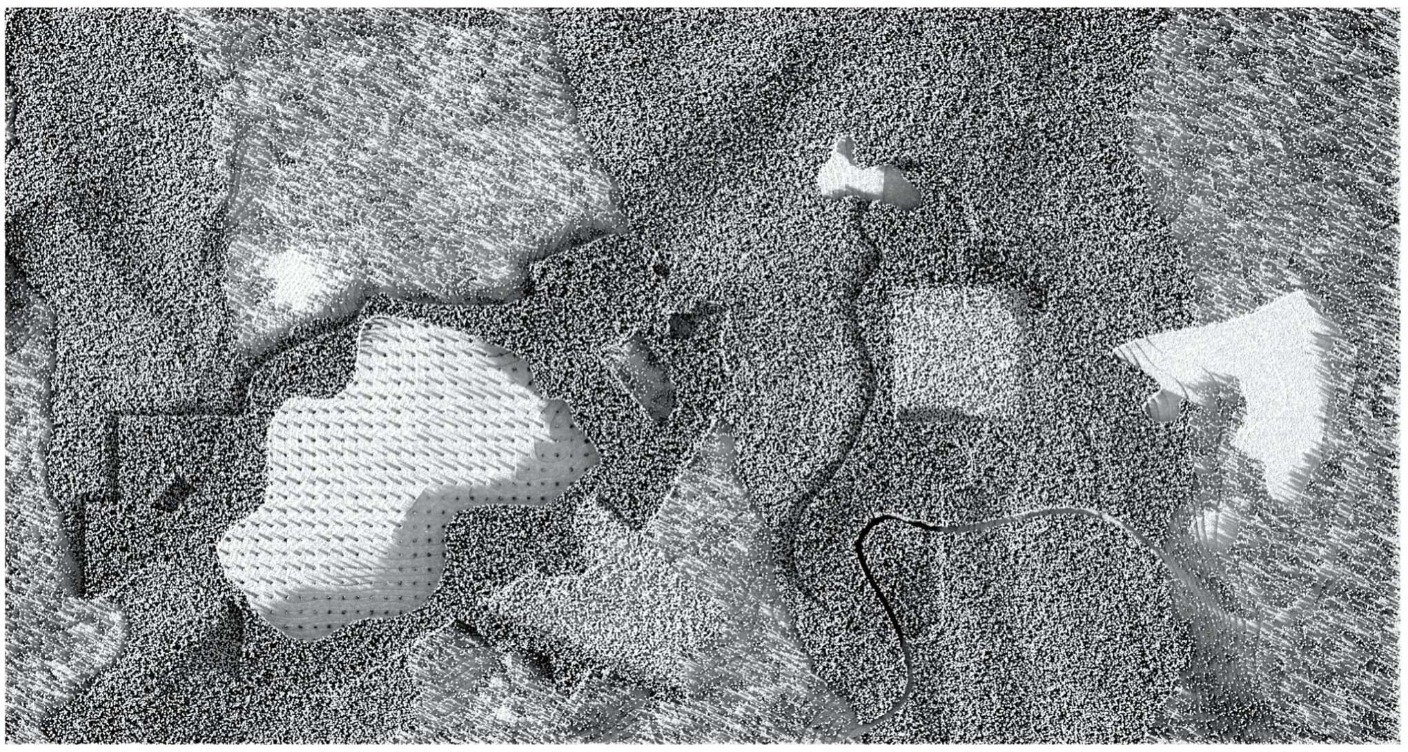
While this work was on course, we (the teachers), were collecting the Lidar (Light Detection and Ranging) databases of the forests around Oslo. I invited Maximilian Schob, PhD student, landscape architect and former student of mine, to help us with the instruction, development and implementation of computational tools to translate these databases into easily understood and manipulated spatial products. Many professors like to promote the myth that a masters studio engages in research, but this rarely happens as students are learning to be designers first and not researchers. So we preferred to avoid taking their attention from design, and as they were experimenting with form in the site-less forest clearing exercise, we conducted the site documentation research ourselves rather than using master students as amateur researchers. Later on, when the students finished the forest clearing exercise, which is absolutely spatial and in many ways very primitive, we provided them with our own research, which is the kind of work we would do inside the office to abstract a site. The students were introduced to the methods in lectures, exposing them to the material. Instead of going to the site, they were exposed to our survey of the site, which is in itself a spatial translation of the survey done by the city of Oslo using Lidar. Obviously, this material is not objective, as it is also a construction by architects based on matter of fact three-dimensional data. In the construction and translation of this material we can induce tendencies to certain aesthetics and references. In other words, in the way we construct the survey we can disseminate geometric tendencies or style, rather than distributing references from other architects.
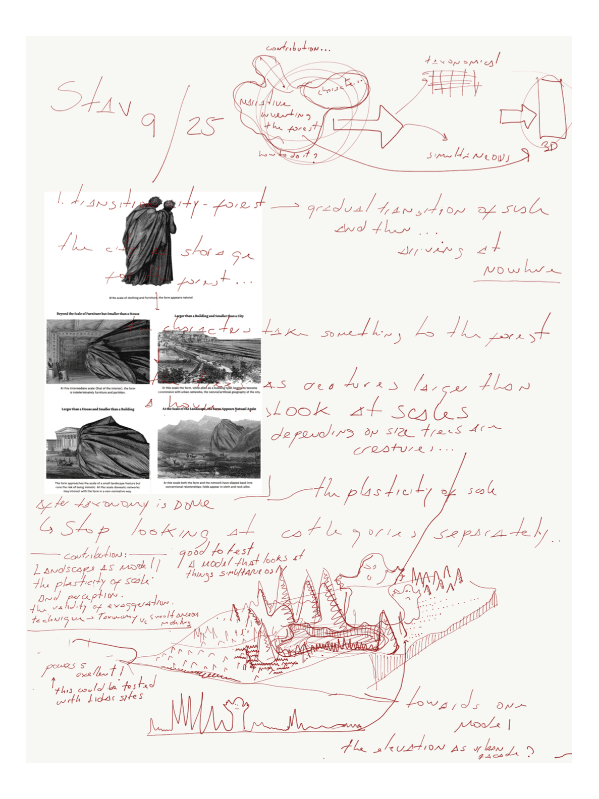
As many schools around the world did, we had to rely on Zoom as a precarious replacement for the important studio environment. This again presented to us numerous opportunities. Much has been said and written about sketching in the design process, but little exists about the role of drawing with students as a pedagogical tool. Generally speaking, there are instructors who avoid tracing over students’ drawings at all costs, believing that students should interpret the spoken word and translate feedback themselves into spatial experiments. Others, instead, sketch intensively, and some are fond of drawing simultaneously with their students. As firm believers in sketching with students, we decided to be transparent about the sketching that happens off camera while listening to the students speak. I thought that perhaps one of the most generous acts we could offer our students located in different parts of the world was to share with them our own sketches and annotations in real time, executed while listening to their presentations.
I planned to take notes by hand while listening to the students and deliver my unedited notes, typos and messy scribbles included, to students right after each session. I would, of course, give spoken feedback as well, but delivering a handwritten note about their work after each individual session seemed like a way to break the distance and face the reality that eye contact in Zoom does not make much sense.
The experiment was productive but exhausting as two sessions per week with Oslo and two sessions with Yale, having thirty students in total, meant that each week I was producing between 30 to 50 individual handwritten notes – around 500 pages during the semester! These notes were all publicly displayed on an open website so that the students could compare sketches, references, and ideas. As the notes were produced using an iPad with a pen, they also contained screen grabs from their work. We are currently working on assembling a book with a selection of 100 pages from the studio.
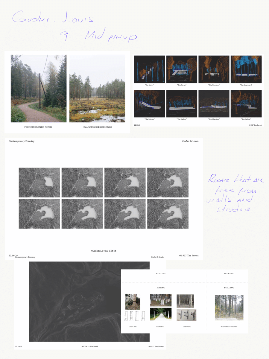
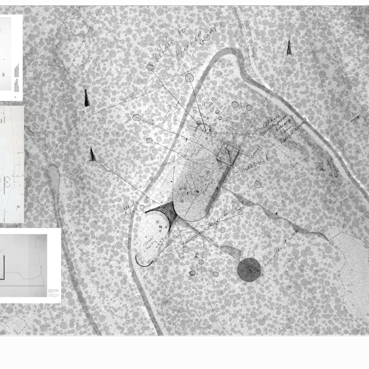
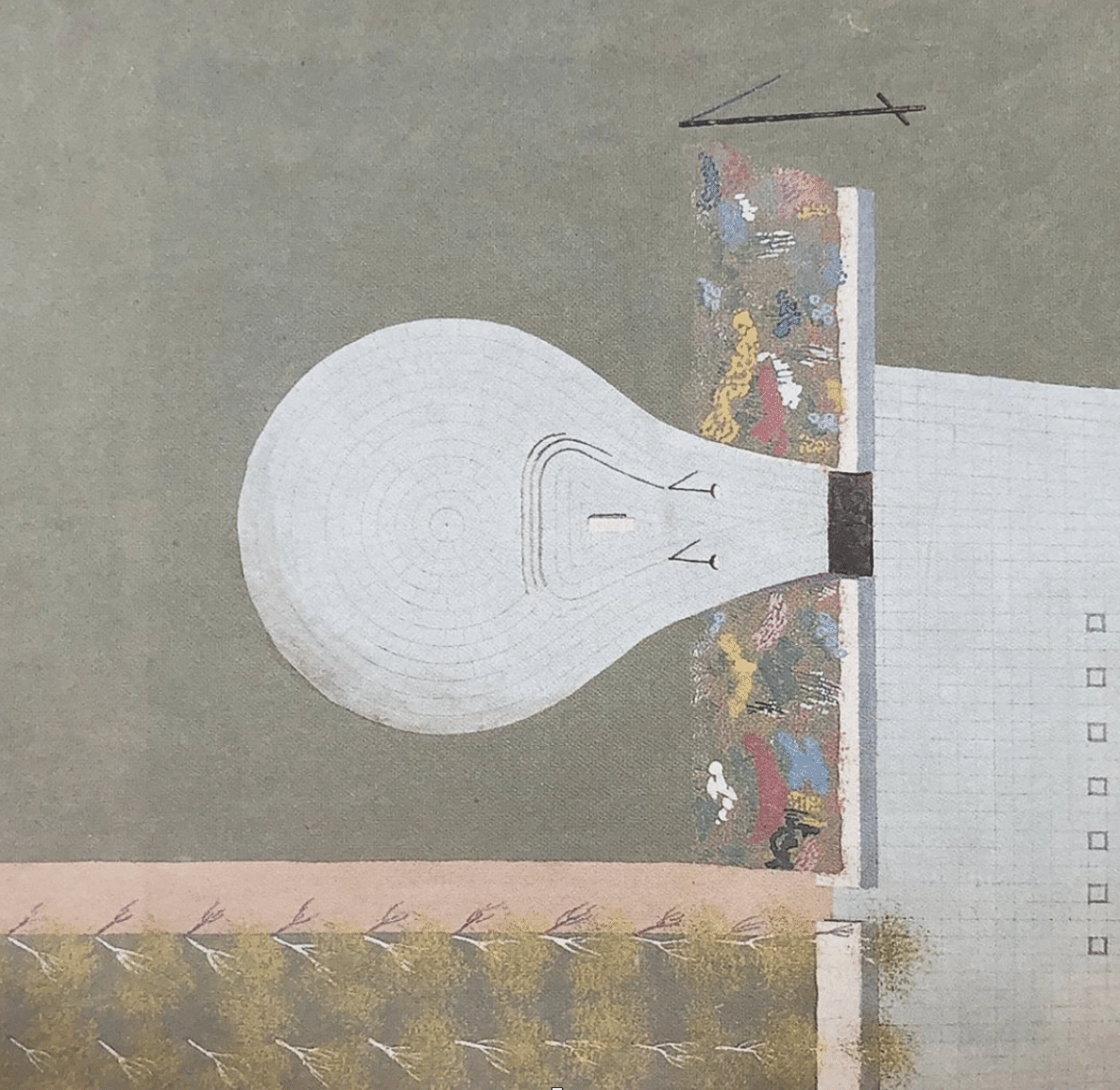
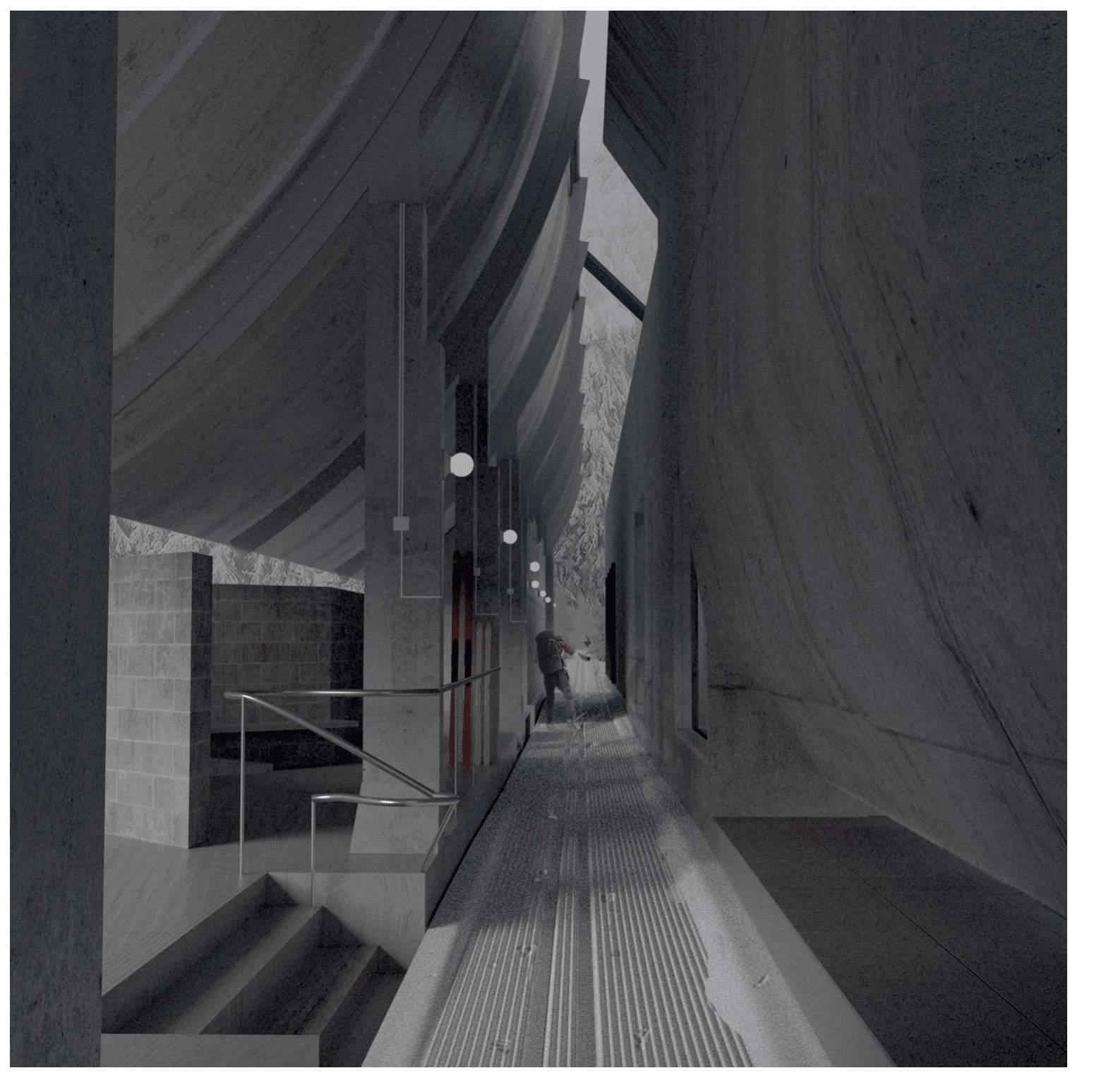
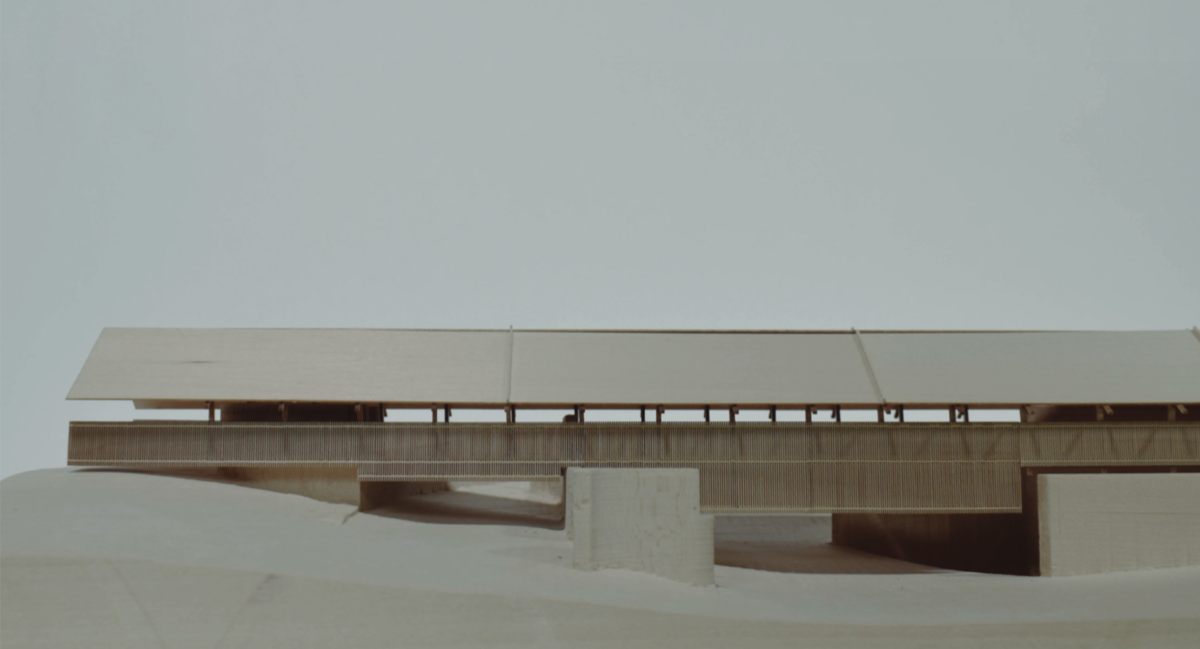
The final step in the studio was to edit the shape of the clearings surveyed with Lidar. The students were asked to design and edit the clearings and propose free-standing buildings at the edges of the cleared spaces. There were only three conditions on our part for the design of buildings.
The first was to situate them in the perimeter of the clearing, not as free-standing objects. The second was to propose a programme inspired by the early Nordic parliaments, which were some of the earliest arenas for political discussion, and, in most cases, were open spaces in the landscape, such as the Thingvellir in Iceland. This was an important decision, as it gave architects and landscape architects equal ground to propose a project. The Nordic open air parliament inspired them to dedicate exterior areas to civic programmes that they often associated with being contained inside buildings.
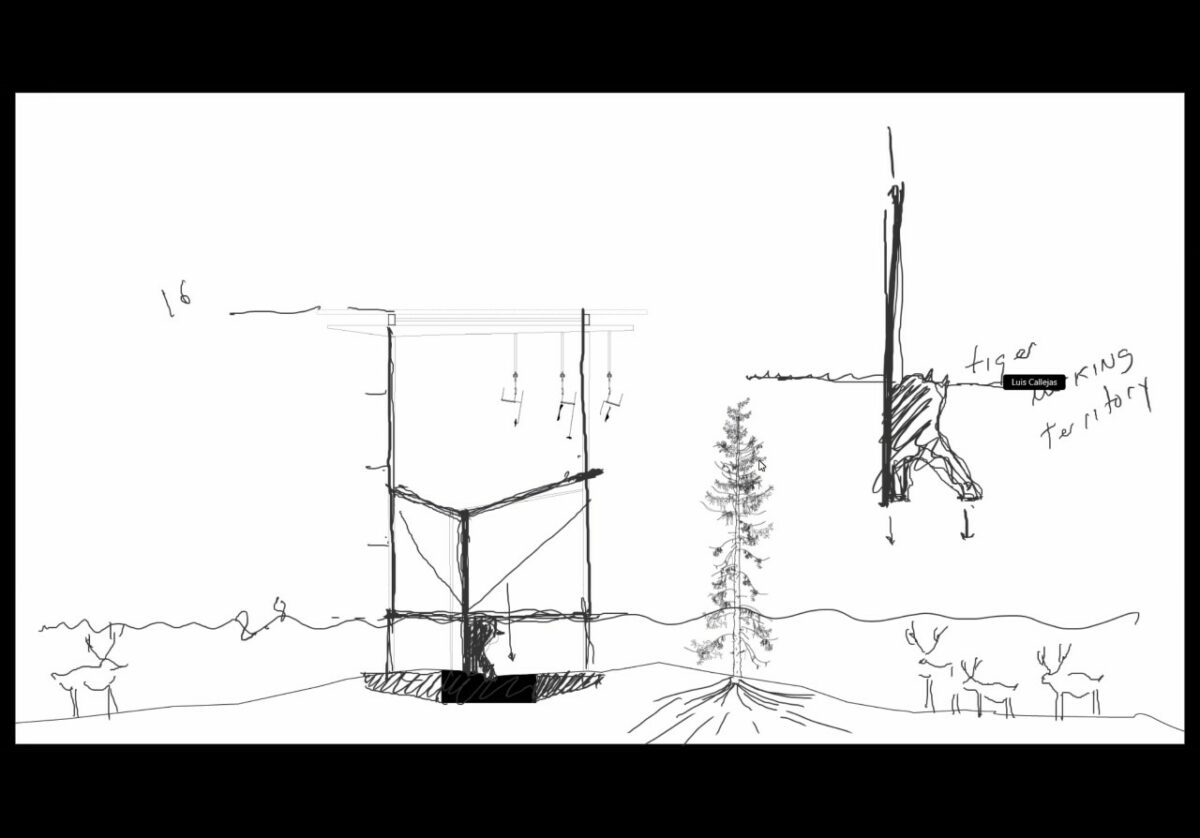
Finally, the primal geometric acts inspired by how the forest is edited had to be translated to structural solutions, not the programme or general dimensions or layout. Structural solutions in our projects and teaching often have a higher order of importance than programme. The modification of topography, and the editing by subtraction of the vegetated mass, were the primal guidelines for early principles of geometry and composition in the structure for buildings.
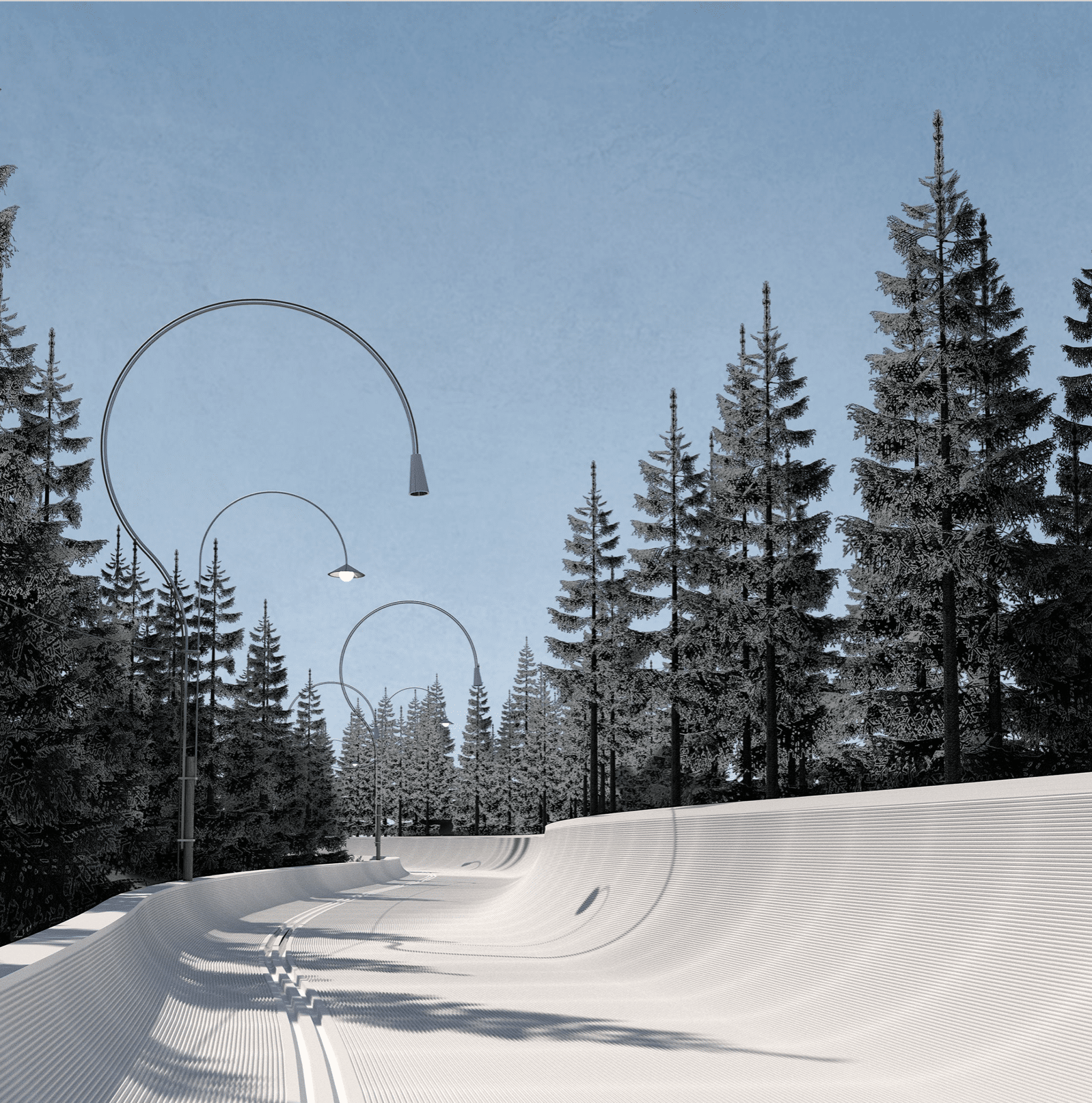
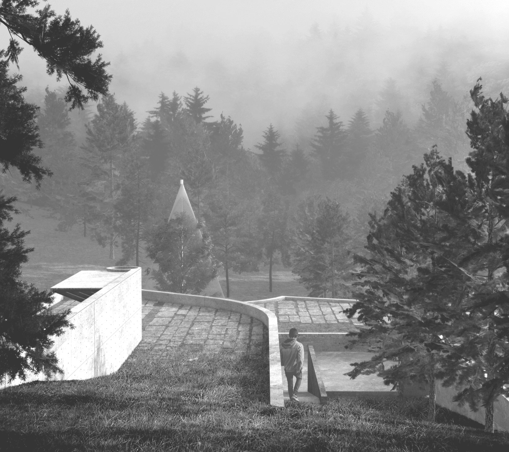
The studio and our ongoing research on the Norwegian forest clearings is not only concerned with challenging prevailing ideas of site specificity. The works and explorations through teaching studios also attempt to document fascinating landscape figures and geometries that somehow do not seem to depend on their relationship to nature. In Norway, a country where many excellent architecture studios can establish sophisticated links to beautiful landscapes, it seems timely to make visible some of the purely artificial landscape formations that typically pale in value compared to natural landscape features. Unlike forest clearings in countries such as Canada, or even neighbouring Sweden, the ever-changing forest clearings close to Oslo obey sophisticated rules that shaped them in a myriad of quirky figures. These figures respect the cycles of the forest and the continuity of ground, and while these figures ironically are a consequence of a desire to perpetuate a romantic idea of a forest, they behave as autonomous forms with an architectural interest. These Norwegian clearings are for us as interesting from a spatial perspective as the best examples of Norwegian architectures, at the same time, they are also comparable to the most exuberant natural Norwegian landscapes that architects often look for inspiration.

– Fabrizio Gallanti