Mapping Water
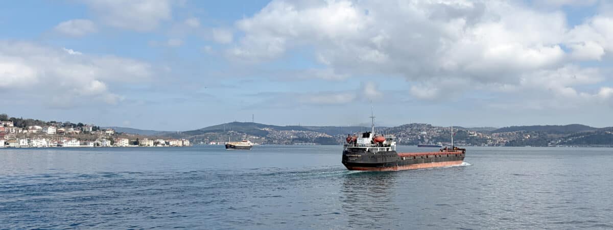
Some years ago, I travelled to Egypt and visited the Suez Canal—the international water passage that connects the Mediterranean with the Red Sea. While standing on a small pier in Ismailia, I watched the huge cargo ships passing; the canal seemed more like a water highway. At the same time, a friend was recounting his memories of watching the bombs falling on the opposite bank during the Six-Day War.
As a pivotal trade centre for more than a century, the Suez Canal has cultivated a sense of openness, allowing a unique cultural osmosis, apparent in the cities that line its banks. In observing the buildings of the colonised regions between the Tropic of Cancer and the Tropic of Capricorn, I found a great diversity in architectural styles. For me, it was clear that this narrow water corridor was an independent and complete entity, powerful enough to determine the history and culture of its environment. It is definitely not the blue void of digital maps, but a territory full of tensions. It is an entity that holds a network of currents, species, infrastructure, history, and human presence, yet upon opening Google Maps we only see one blue tone.
Born out of a perceived limitation of the ways water has been conventionally represented, I decided to approach water bodies as independent, urbanised, and historical territories by analysing three cases of international maritime passages; specifically, the three passages of the Mediterranean—the Bosporus, Suez Canal, and Gibraltar. All three are located on geopolitical points of high strategic importance, where intense and systematic human activities have been taking place since prehistory, and each has a unique intercultural character. Each is also defined by limited space, compressed by terrestrial masses, sites of human and natural congestion.
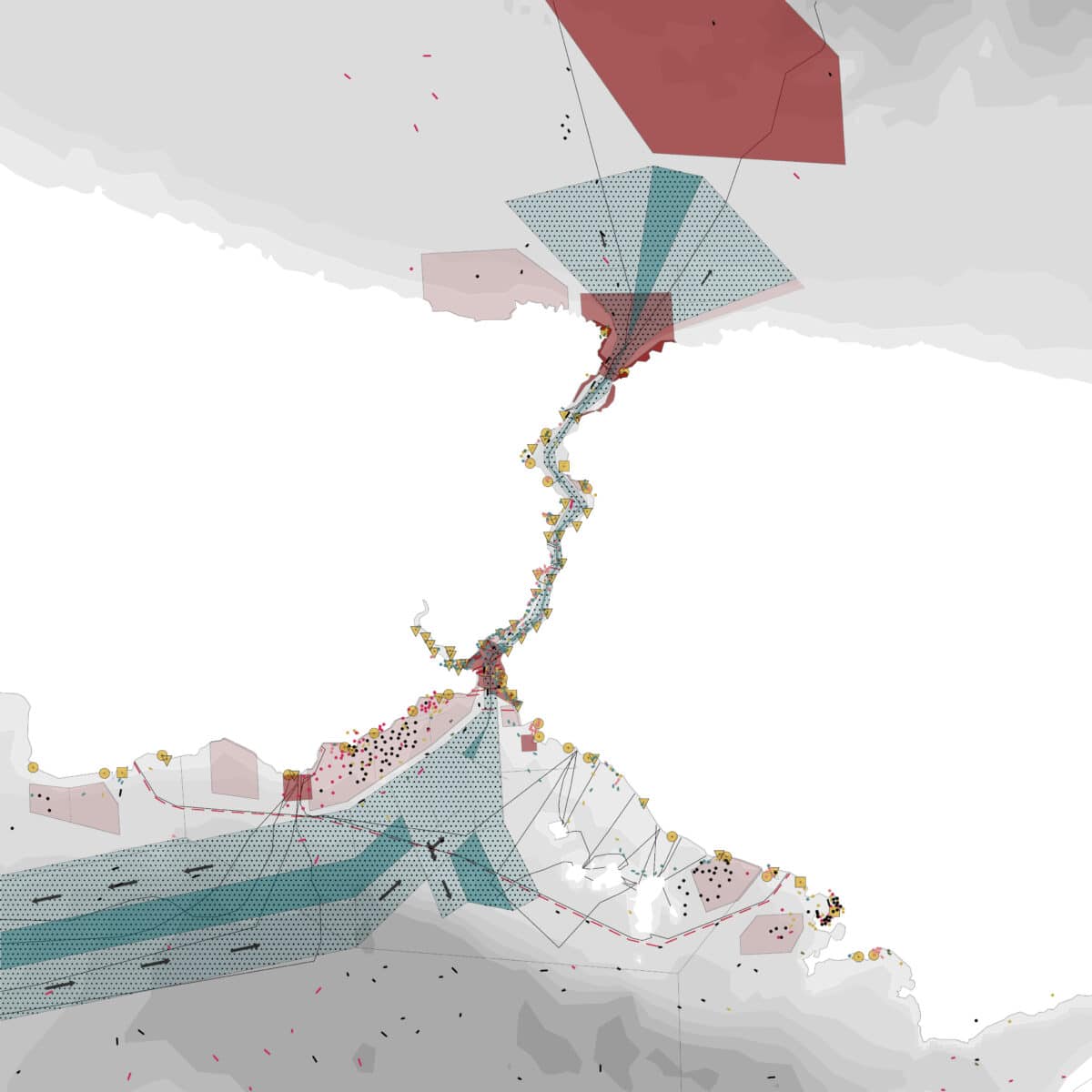
My main endeavour was to map the hidden and overlooked aspects of these maritime corridors. Each of the passages was mapped, depicting the bathymetry, national and international borders, port facilities, underwater infrastructural systems, demarcated and regulated zones of marine navigation, as well as the average maritime traffic. After the production of all the respective maps—six for every passage—I layered them, producing a composite map for each passage. The terrestrial zones of both sides of the straits were depicted in white without information.
The Bosporus Strait is the only passage connecting the Mediterranean and the Black Sea. Drawn above at a scale of 230,000 it allows one to see it as a funnel that concentrates, compresses, and releases activities in both directions. The map makes clear that water bodies are active territories, having the ability to separate, exclude, unify, and determine not only space, but also time, evolution, and history.
Upon showing the map to others, most identified the white as the water, the coloured areas as land; within our understanding of maps and territories, we need to reevaluate our liquid realm and develop new ways of depicting its anything-but-blue void.
*
Anna Biza is an architect and set designer with a Fine Art, Stage Design Master’s from Trinity College Dublin, based in Athens.
This text is one of the selected responses to the second category of the Open Call 2025: Visibility, and the Unseen—a series of short contributions that either bring to the surface the unseen drawings within the Drawing Matter Collection (I. In the Archive) or explore original architectural drawings, created by the author(s) of the contribution, which make visible the unseen (II. In Practice).

– Tom Cookson