Drawing Research Platform, London, 2025, ENAC Summer Workshop
– Raffael Baur, Patricia Guaita and Matthew Wells
For a fourth year, Drawing Matter hosted students from ENAC EPFL for a week-long workshop on survey drawings—this time not in a Somerset farmyard, but in Lincoln’s Inn Fields, 400 yards east of the archive. The workshop was organised by Patricia Guaita and Raffael Baur in collaboration with Drawing Matter, with invited expert Matthew Wells delivering two lectures throughout the week.
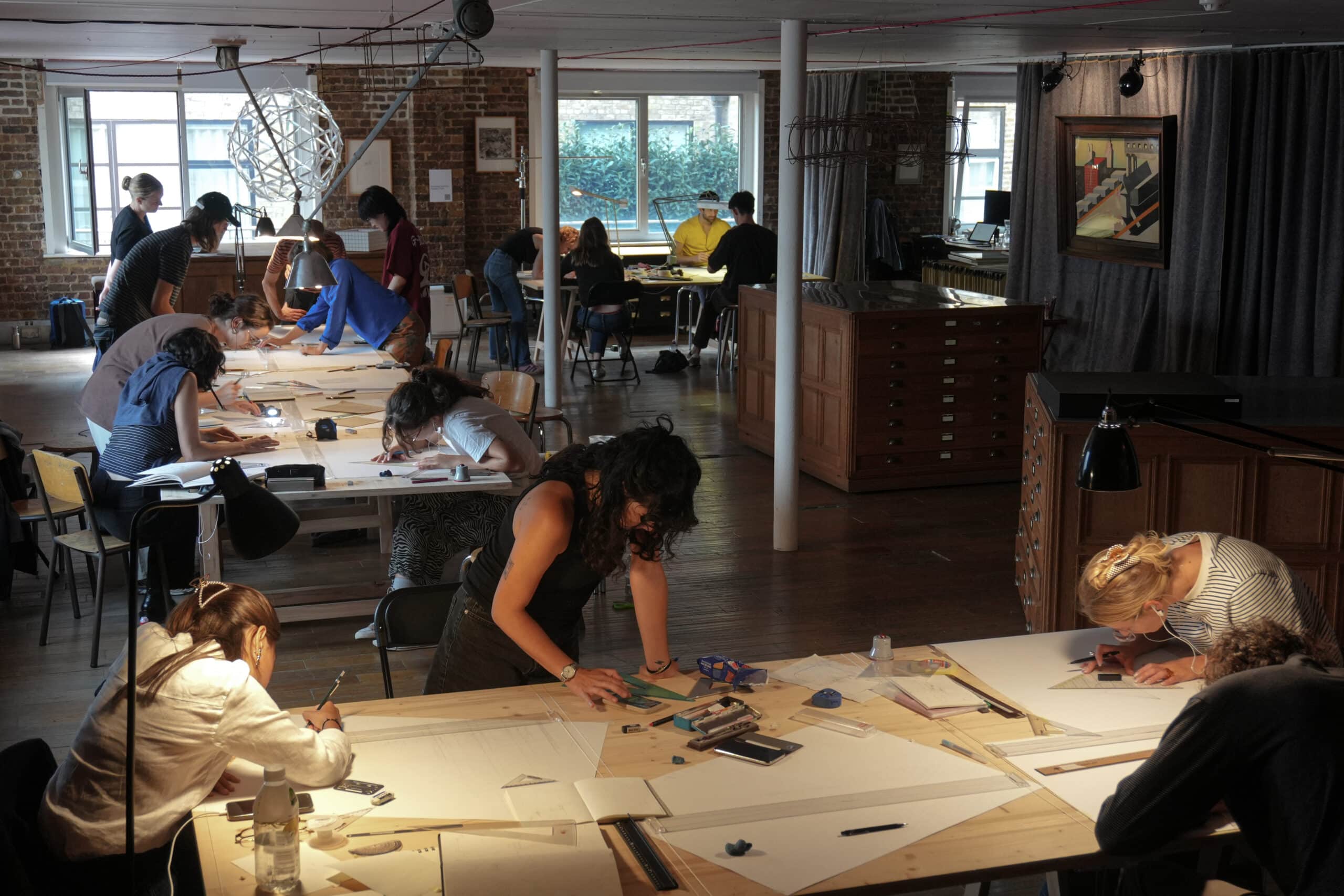
In this year’s workshop, students explored drawing as a fundamental tool in architecture and engineering, engaging with the site as both a built environment and a historically transformed place. The students were tasked with constructing survey drawings—understood as instruments for potentially transforming existing conditions—while investigating drawing as a bodily practice of measuring, analysing, and questioning spatial, tectonic, urban, and material articulation, as well as the notion of place. Drawing was presented not as a technique of representation but as a mediator between construction and the individual: a cognitive tool, a physical act, and as its own form of construction. The slowness and tactile nature of manual drawing and construction build tacit knowledge, fostering an awareness and economy of means. Through systematic testing and observation the students explored the tactile qualities of construction, its relation to scale, and how that can inform design.
– Patricia Guaita and Raffael Baur
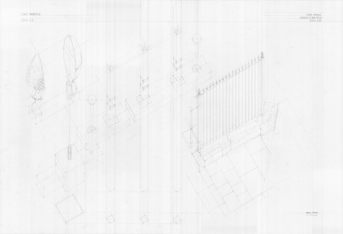
Héloïse Marquès and Löic Mundinger: On the scale of a barrier, the city reveals itself. Measured both as a whole and in the details of its construction, it encompasses both function and memory. At Lincoln’s Inn Fields, the passage of time is evident in the peeling paint, in the rust that forms delicate patterns, in the dents left by a few car accidents. The stone base still bears the marks of old fences, once removed and melted down during the Second World War to recover the metal. Every day, a rhythm takes shape: in front of the barrier, bicycles gather and disperse, people arrive and depart in a choreography that repeats itself daily. Nearby, food is offered to the most disadvantaged, lives briefly intersect, and the barrier remains motionless, a witness to history and everyday urban life. 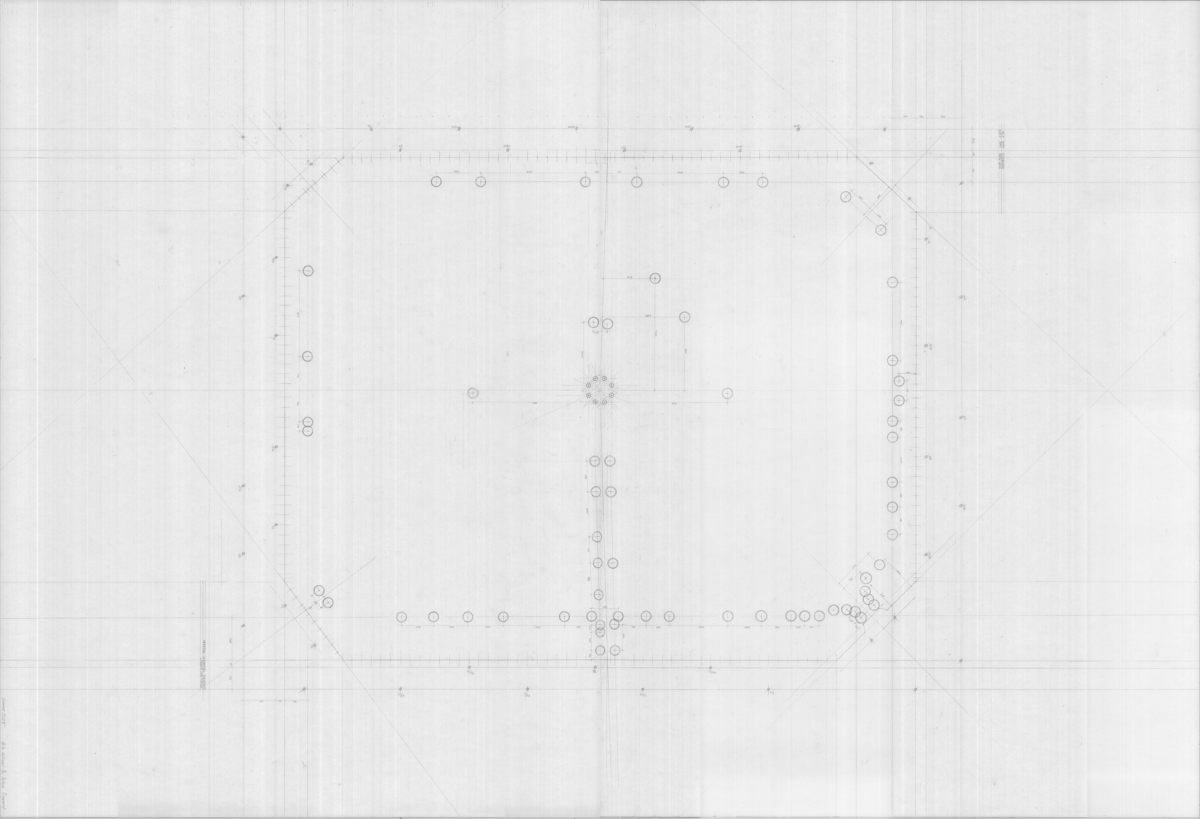
Selma Gaumet and Arla Williams Roffe: This project singles out banal and repetitive objects, trash bins and barrier posts, from the horizontal plane forming the ground of Lincoln’s Inn Fields park. Originally placed to answer purely practical needs, these elements became, once extracted, unexpectedly eloquent about the park’s structure and modes of operation. Thanks to their serial and punctual qualities, they also served as instruments of measure for us. Quite like in a rigorous notation system, these elements got transformed into repetitive symbols that guided us in surveying this park. The plane is no longer represented as a continuous whole, but as a system revealed through the repetition and distribution of its most ordinary elements. 
Lydia Genecand and Raúl Hansra Sartorius: A lush island, Lincoln Inn Fields as part of an ensemble of vegetation archipelago in the City; built artefacts gravitating around its indefinite border, forming a porous frontier of fluid purpose. Not really private, not really public, neither monumental nor domestic. Relics of land ownership, they are totems to the idea of private property. Our interest lies in that urban fissure, the frontier between the now public square and the front yard of private buildings. Mapping this non-park, drawing where geological nature replaces trees and grassy surfaces of the field, reminding the wanderer of their imminent re-entry into London’s urban ecosystem. Reflecting these uncertain conditions, the measures build themselves on precise tools (a measuring laser and tripod), yet open to interpretation through the bodily relation to the medium: the subjective hand and eye guide our instrument. 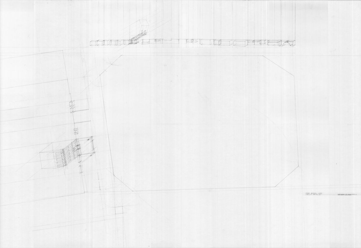
Jacopo Taccari and Nicolás Gemelli: Lincoln’s Inn Fields crates a void within the dense urban fabric of the northern riverside of London. A defining special quality of this square is determined by the relation of the buildings’ fronts and the streets which frame the square. Indeed, the vertical axis of the facades meets the horizontal plane of the street through an intermediate space. Although this space takes on different configurations and functions for each building plot, it always presents a sunken front garden under the road’s level, a typical feature of the terrace houses in London. In some cases, the connection between the street and the building’s entrance is permitted through narrow bridges over the sunken garden. This entire intermediate space functions then as a diaphragm between the houses and the park. Three sides of the rectangular square present facades of different scales, as well as intermediate spaces of different sizes. In the northern side the scale of the front gardens is smaller, differently from the bigger ones on the west side. The smaller ones are privately owned, while the bigger ones have a semi-private quality. Despite of the scale difference of the buildings the same recurring system is present. The interesting relationship of voids of these diaphragm spaces and the park became the centre of the drawing research. The front gardens destined to the individual building defines a tight rhythm along the facades in contrast with the large park space in the middle. This morphology of space represents well the dynamics of English society and its relationship in the public space. Through the drawing research and the use of colour, the hidden qualities of these front gardens emerge as a critical element to understand the urban morphology of the square. 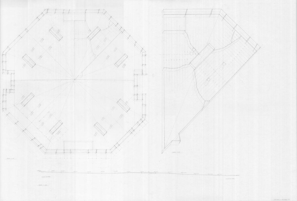
Julia Weber and Yanpeng Zhang: In the centre of the park, we focused our attention on the base of the pavilion. Rather than analysing the entire structure, we specifically examined the foundation, the part that most clearly bears the traces of time. We were interested in the marks left over the years: the old structure overlaid by the new, as well as the forces that created cracks and shifts. We saw these not merely as damage, but as visible records of stress, movement, and duration. We proceeded systematically: the octagon was divided into its eight segments, the cracks were measured every ten centimetres, and the section was recorded at intervals of two meters. In this way, we combined precise measurement with a shared interest in the dialogue between architecture and engineering, between form, construction, and the forces acting upon it. 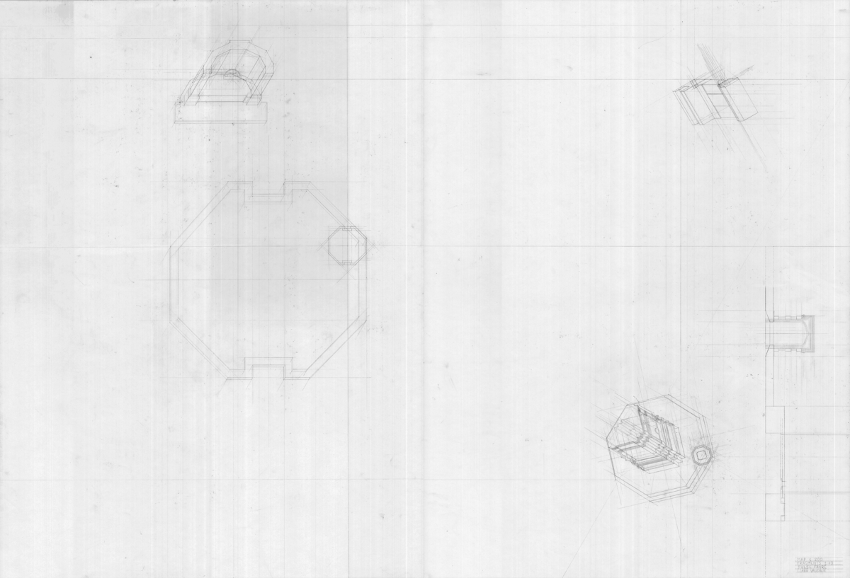
Julie Audrey Favre and Clara Vaudaux: London is a city filled with history and poesy. Facing Sir John Soane’s, now museum, residence, the Lincoln’s Inn Fields park is part of the city’s rich heritage. As you walk around the park, you are accompanied by sculptures and monuments that marked this landscape throughout time. Our drawing represents the plan of the park through those beautiful landmarks, and how the park extends its limits onto the city through the historical buildings surrounding it. Moreover, the position of our work on the paper is not exactly centred but shifted to the side to incorporate the neighbouring historical gate. The monuments are first drawn in plan at a small scale, and then in axonometry at a bigger scale, expressing their many details. Their axonometry orientation is defined according to a visitor’s point of view and show the relationship between the monuments. The drawing aims to become a promenade of memory, retracing moments in history through their physical embodiment. 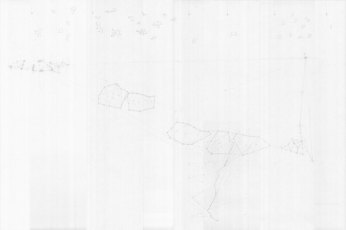
Lisa Girard and Auguste Pachoude: When entering in Lincoln Inn’s Field, we searched for an element—singular, platonic. Abandoned, or perhaps deliberately placed here, we stumbled upon this stone. Barely two meters from the entrance, at the edge of the path, a carved stone, shaped by human hands and worn by use. On its upper face, a particular mark bears witness to a past story. Before the war, this stone marked the boundary of the field. Today it has been replaced, and so it remains here, adrift. Intrigued, and convinced by this element as a threshold into the park, we entered again six times, each from a different side. At the next entrance, we encountered the same phenomenon. This time there were two. Haunted by their former life, hollowed, emptied. And then, at another entrance, we found other stones. Many. They seemed different. Freed from a previous function. Organic, either deposited or as if they had always been here. What draws us are their interactions. There are at least a dozen. And just a few metres further, the same again. So we began to catalogue them. To understand their positions in relation to one another. To imagine their substance. To caress their texture. 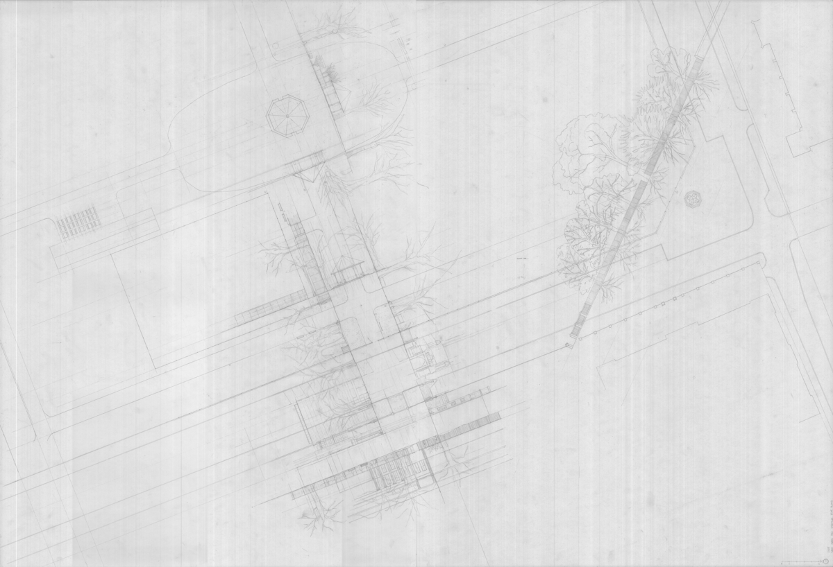
Paul Schaffner, Sarah Carroz and Ayumi Alexis: The drawing emerges from an observation of the park’s contrasting atmospheres, spaces that shift not only through layout but also through the presence and density of trees. In certain areas, where tall trees are absent and smaller bushes border an open lawn, the park reveals itself as an expansive area, inviting occupation and movement. In contrast, other zones are defined by higher trees forming canopies, creating enclosed spaces that narrow perception and transform the space into something more intimate, almost secretive. To capture these variations, three moments were chosen: the centre of the square, the southern gate, and the entrance in the south-eastern angle. For each moment, unfolded plans were drawn to express the different atmospheres of the park, all reconstructed through transparency. Superpositions emerge; trees overlap, objects accumulate, and volumes of enclosure or openness become legible. At the pavilion, the drawing reveals a relatively open atmosphere, where fewer trees soften the sense of boundary and generate a spatial release. By contrast, the southern and south-eastern points convey a denser, almost confining space, where the layering of objects produces an intensified sense of enclosure. The drawing offers both an overview and an immersion. It provides a plan of the park while simultaneously allowing one to step inside and imagine its atmospheres, oscillating between openness and constraint, into a spatial narrative. 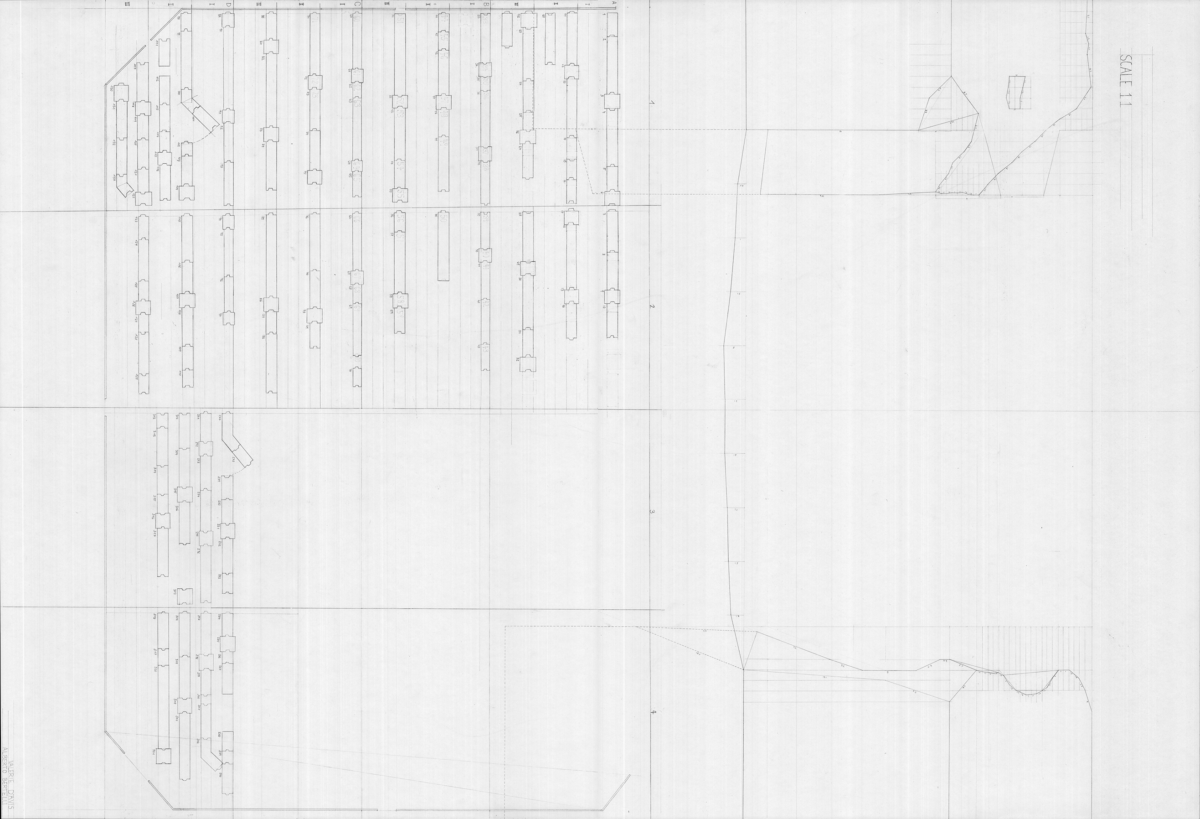
Valerie D’Avis and Alberto Bertelli: Lincoln’s Inn Fields lie in the densely built city, a rectangular space embedded within the surrounding buildings, forming a distinct open field. The area is enclosed by a fence whose gates are locked at night. Although the park is public, the fence conveys a sense of restricted access. Parallel to this fence runs a low wall, about 20 cm high, built from stone fragments of varying sizes. Its surface, marked with circular holes, shows that it once served as the foundation for the fence. The original steel fence was dismantled during World War II, melted down, and reused for weapons. The war left behind an open field, bordered only by stones. Later, a new fence was installed, placed not on the old foundation but beside it, driven into the ground. The stones were left in a row, unused remains of a former time. Walking around the park, one can see where parts of the stone wall are missing. Like gaps in a row of teeth, pieces have been removed. These stones reappear at the park’s west and east entrances. Positioned there, they mark the entry points like small sculptures and are sometimes used by visitors as seats. Their dimensions suggest that they once fit into the holes of the old wall, which are now filled, in an odd way, with extensions of the steel fence. For the analysis of these holes, the fragments were measured and treated as standardised elements, with their height assumed to indicate what continues underground. The stone as displaced filler and the hole as a leftover of history take on an urban character. From the park as an enclosed public space to the openings left by the removed stones, extending into the soil. The ‘urban void’ appears again, both in detail and in the boundary that defines public space. To relate the missing parts of the wall, an archaeological table allows for the documentation and archiving of each removed fragment. The list records the position of the gaps and illustrates the puzzle-like course of the foundation.
Download high resolution scans of drawings.
Notes on Two Lectures
London
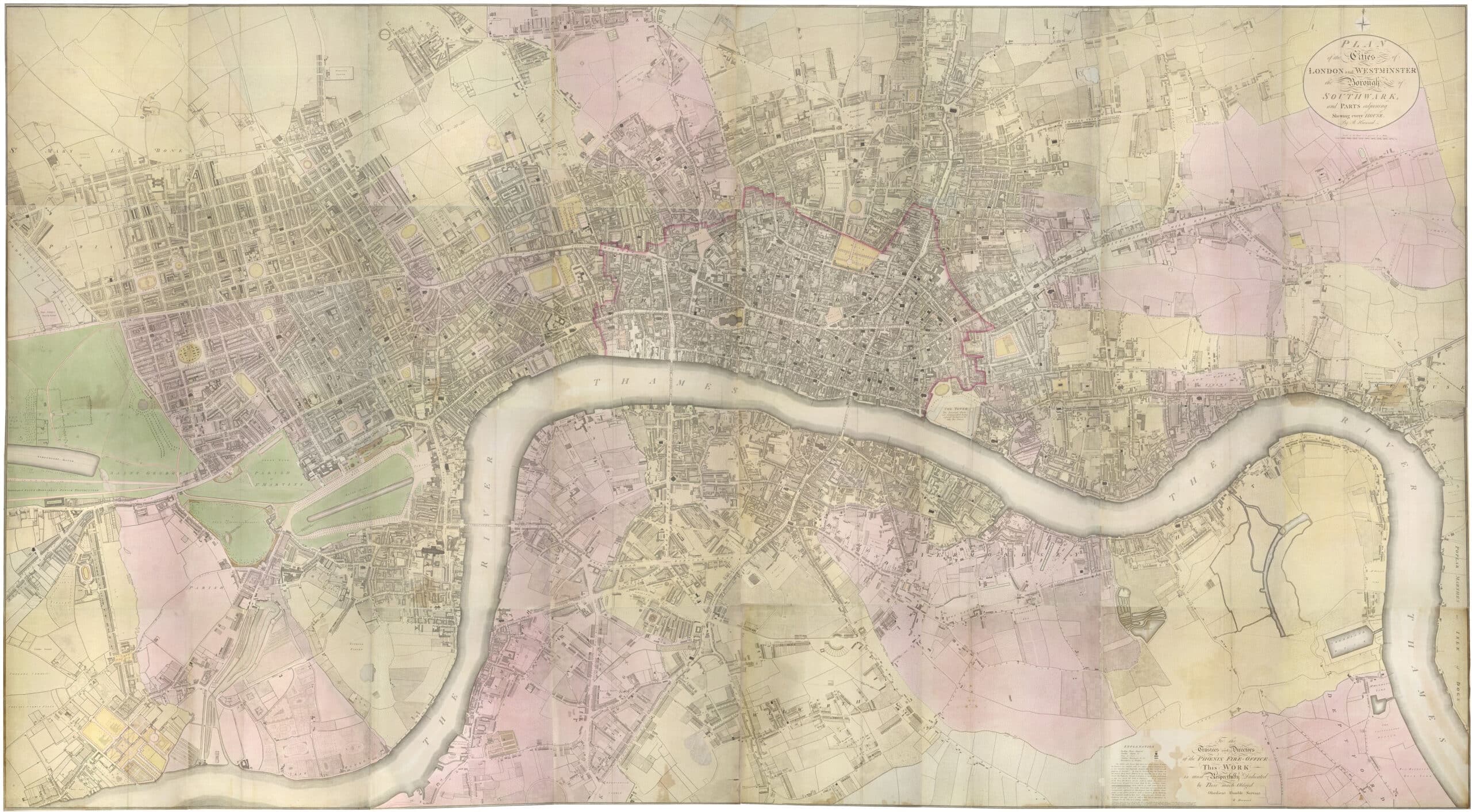
We started by looking at Richard Horwood’s Plan of the Cities of London & Westminster (1792) with its measured lines of possession. Horwood’s survey belongs to that moment when London’s edge was not the North Circular but a set of fields. Less a picture of London than a set of instructions for its conversion: fields into frontages, hedges into rights, pasture into rentable depth. As always in London, two centres run in parallel: the City’s mercantile circuitry and Westminster’s courtly apparatus. The West End arrives as connective tissue, a speculative splice joining these zones. What looks like ‘growth’ is really boundary-work: hedgerows smoothing into property lines, property lines hardening into blocks, blocks tessellating into an urban surface. Historic maps register this transformation as a slow overwrite, a palimpsest of enclosures. Aristocratic names appear—Fitzroy, Bedford—while adjacent plots remain temporarily blank, waiting to be reprogrammed by institutions that will later occupy the same grid, as though London were always reserving capacity for the future.
In these squares are arguments in brick: the terrace as an instrument that learned to pass for domestic architecture. The London house is less a ‘home’ than a strip of calibrated depth, a frontage rationed for profit, repeated to make roads and sewers financially viable. The plan is a sequence of zones: front rooms pressed against the street; a middle garden, part amenity, part light-well; a rear world of service—stables and servants where money allowed, the outdoor toilet where it did not. Its vertical section is equally telling. The shallow basement, the excavated earth thrown forward to raise the road, produces a small but decisive estrangement: the garden level as something like ‘nature’ and the street as manufactured datum. And who, in this history, counts as an author? Not the architect, not yet, but the master builder—carpenter or bricklayer turned entrepreneur—working through the leasehold system: a long lease, a brief holiday from rent, a brick shell erected fast enough to be sold on before liabilities bite. Borrowing, contracting, profit-shares: finance as construction detail. By 1774 the Building Act arrives to tidy this mess into categories—rates, values, areas, codes, manuals—turning variety into typology, typology into streetscape. London becomes legible through this regulation: typology as law, repetition as streetscape, the parapet as firewall and signature.
*
Survey
Knowledge begins when the world is forced into two dimensions and made portable: when things become documents, records, marks that can travel and yet still function as references. A brief scene is offered here as an analogue for architectural practice: a small group of specialists confronts a landscape whose condition is disputed. This dispute is settled not by a more authentic act of looking, rather by the construction of a chain of references. First, a large map is compared against photographs; one inscription corrects and compels another until the place can be handled at a distance. Inscriptions here are the operative medium: marks, tags, registers, samples, notebooks that mobilise traces while retaining their authority as evidence.
A mundane example: imagine the painted number on the corner of a café table. Without an agreed mark, there is no navigation, no coordination, no distribution of labour or cost. Survey drawing functions in precisely this way for architects. Like the estate plan that converts fields into frontages, it is a technology for turning the thickness of the world into a legible, standardised surface that can circulate between desk and site, office and contractor, present condition and future intervention. The survey is therefore never neutral. It supplies the quantitative guarantees required for construction—magnitude, alignment, tolerance—but it also participates in the wider apparatus of property and control, in which grids, categories, and conventions stabilise what a place is allowed to be. For the students, the point is that the survey drawing is not merely a record of a building; it is the first, decisive act of design, because it frames then codes a reality in the very moment it claims to describe it.
– Matthew Wells
