In the Archive: New and Found 4
– Editors
Click on drawings to move.
The New and Found series is an informal miscellany, which allows us to show some recent acquisitions together with material in the archive or the libraries at Shatwell that you may not have seen before.
New
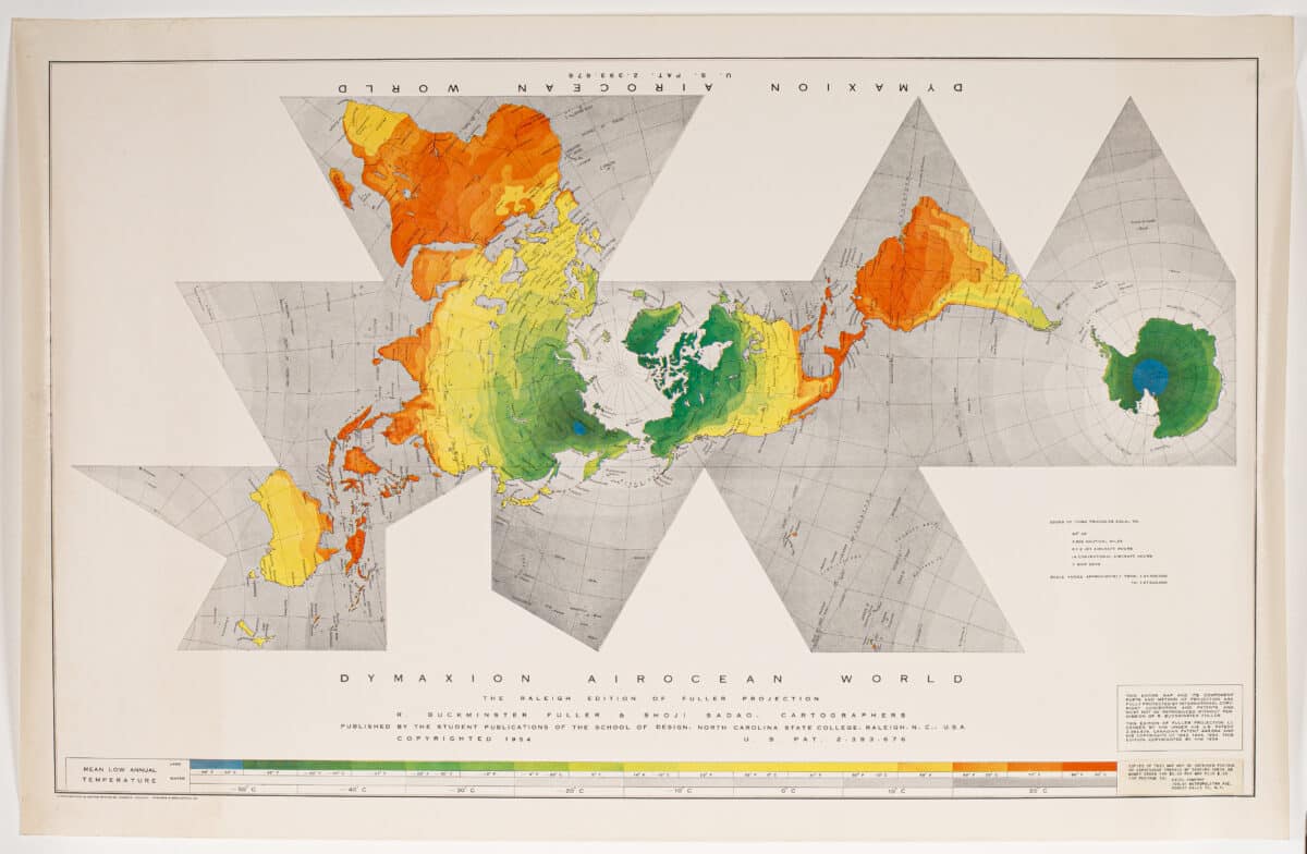
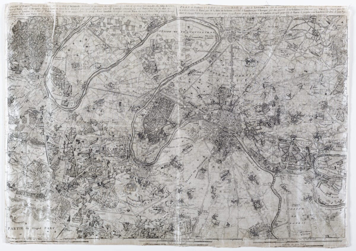
On the digital planchest this time is a collection of cartographic items: from the delicate studies of Nimbus clouds (from the pages of the Atlas International des Nuages), John Rocque’s Map of Paris printed on silk, Buckminster Fuller’s Dymaxion, Air Ocean World Map, to Tim Robinson’s folded map of Burren, County Clare, Ireland.
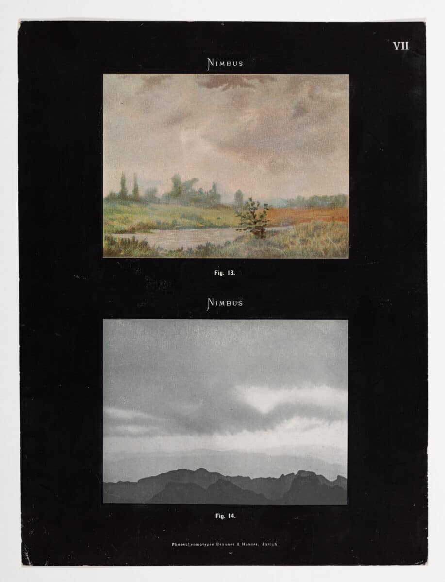
The Nimbus page taken from the Atlas’ first edition was to promote a consistent use of vocabulary when describing clouds. Its images are a key to a universal understanding of weather formations. Fuller’s Dymaxion Map aims for a different type of accuracy in depicting the world, rejecting the representation of Mercator maps we are accustomed to, which distort scale in order to flatten the spherical earth. A distortion that, no doubt incidentally, enlarged the apparent area of Europe and the USA at the expense of equatorial latitudes and the ‘Global South’.[1] Rocque’s map of Paris is also part of a cartographic desire for accuracy. There is attention to detail, which can be seen as Roque varies line weights to highlight buildings and define property boundaries. Yet the map is part of a larger political body of work; the printed caption states that it is ‘a plan of Paris, reduced to the same scale as that of London. In order to ascertain the difference of the extent of these two rivals.’ Commissioned by ‘his R.H. the Prince of Wales’ it sets out to demonstrate London as a larger, more advanced city. The map was printed on silk so the Milords could carry them around Paris in their pockets, at once both a map and handkerchief. The folded map of Burren also has a political undertone but through its correction of the seemingly accurate Ordnance Survey of the area. Originally mapped by the British Military between 1824 and 1846, Tim Robinson’s map is overlaid to amend the anglicisation of place names and include the ‘fading oral culture’ of the area.[2]
Found
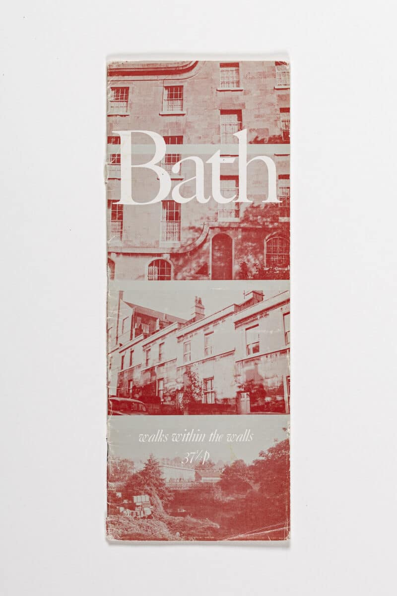
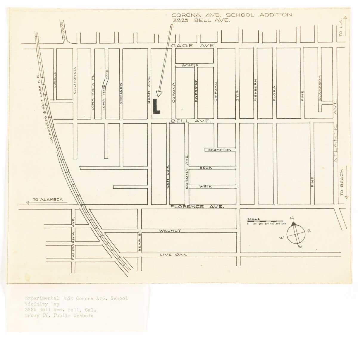
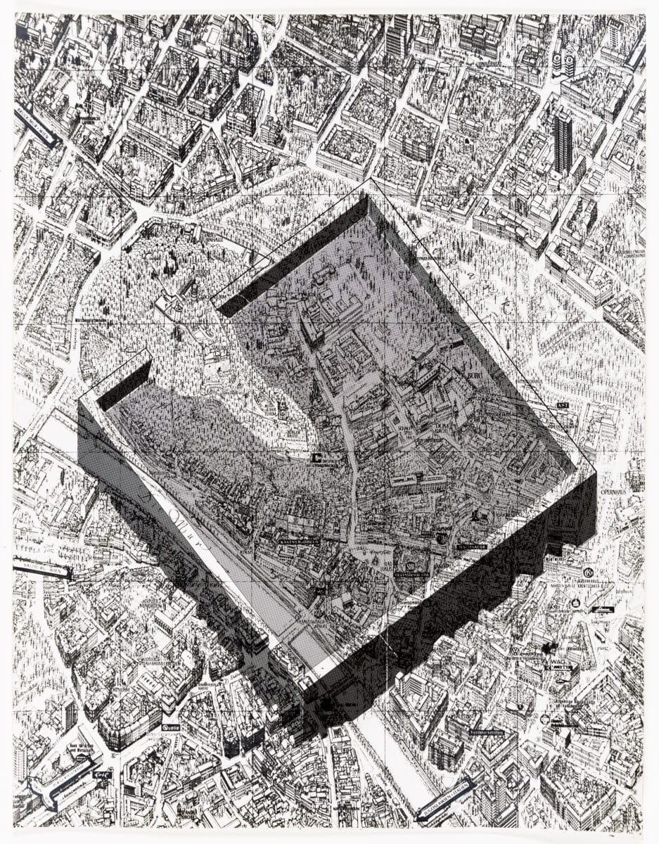
‘Start walking in South Parade.’ ‘Then cross, over Pulteney Bridge.’ ‘Now cross to the corner of Johnstone Street and Laura Place.’ Peter Smithson’s Bath: Walks within the Walls tells us where to go. It is an instructional manual of routes, simply drawn on a map with a dotted line, as well as written out and illustrated with photos. But the text is not solely written in this direct tone, as Smithson describes the city narrating his thoughts on various architectural details. Richard Neutra’s street map of Corona Avenue School, on the other hand, keeps to its instructional nature. The school is outlined on the corner of Bear Avenue and Bell Avenue, while the addition of a long arrow emphasises further the location of the school. Similar to Smithson’s musings on the city, Superstudio in their ‘Flooding in Dry Ice’ series works with a dominating structure over an existing map: the city of Graz, Austria is still visible through the opaque structure, but one can’t ignore the urban hypothetical intervention.
Notes
- ‘Dymaxion Map’, Buckminster Fuller Institute, <https://www.bfi.org/about-fuller/big-ideas/dymaxion-map/> [accessed 10.06.2024].
- Tom Cookson, ‘Tim Robinson: Deep Mapping’, Drawing Matter, 26 February 2024 <https://drawingmatter.org/deep-mapping/> [accessed 10.06.2024].
